The Po, One Year On
Fifteen PlanetScope comparisons, almost always taken on the same day in August in 2025 and 2026, along the river, its tributaries and the glaciers that feed it
Published on Il Post · 14 August 2026
In the summer of 2026 the Po river basin is going through one of the most severe water crises of recent years. On 6 August the Po river district basin authority confirmed a “high” level of water-scarcity severity district-wide. The bulletin of 13 August recorded severe drought conditions, according to the thirty-day SFI index, at almost every reference hydrometric section, with Cremona and Borgoforte in extreme drought. On 12 August the flow rate at Pontelagoscuro, where the Po meets the sea, was 233 cubic metres per second, well below the 450 cubic-metre-per-second threshold that marks the risk of saltwater intrusion into the delta.
The large pre-Alpine lakes that regulate the river’s flow in the summer months are also struggling: Lake Maggiore is in extreme drought, Como and Iseo are in severe drought, while only Lake Garda remains within normal range. According to the Copernicus European Drought Observatory, updated to 10 August, this summer the Po — along with the Rhine, the Danube and the Loire — reached the lowest levels ever recorded in August; at the end of July around half the territory of the European Union and the United Kingdom was under some level of drought, with 9% on alert status (against 11% in the same period of 2022 and 3% in 2018).
Upstream, exceptional heat is also accelerating the melting of the glaciers of the Mont Blanc massif, which feed part of the Alpine water reserves: the ARPA Valle d’Aosta weather station at 4,750 metres recorded above-zero temperatures several times in the second half of June 2026, an anomalous condition at that altitude.
The effects are visible along the entire course of the river. In Turin, where according to ARPA Piemonte the Po basin received 36% less rainfall in June and 54% less in July compared with the 1991-2020 average, the Po has hosted an abnormal algae bloom since late May that the city has been unable to contain despite removing more than 200 tonnes of vegetation. In the rice paddies of the Lomellina and Vercelli areas, the Est Sesia irrigation consortium has for the first time introduced a water-rationing rotation system between the different districts, and Confagricoltura Pavia estimates losses exceeding 100 million euros for the local rice-growing sector.
The fifteen pairs of PlanetScope images that follow compare the same location a year apart, almost always on the same day in August between 2025 and 2026: drag the vertical bar to see before and after.
The glaciers upstream
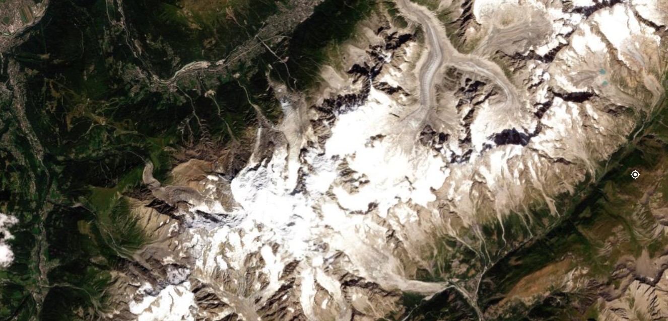

Figure 1 — Mont Blanc, 8 August 2025 / 8 August 2026. The slope between the Miage and Brenva glaciers shows, in early August 2026, a thinner snow cover and more exposed glacial margins than in the same period of 2025. The ARPA Valle d’Aosta station on the summit, at 4,750 metres, recorded above-zero temperatures several times in the second half of June 2026, an anomalous condition at that altitude that accelerates the melting of snow, ice and permafrost. Source: Planet Labs PBC.
Lake Maggiore
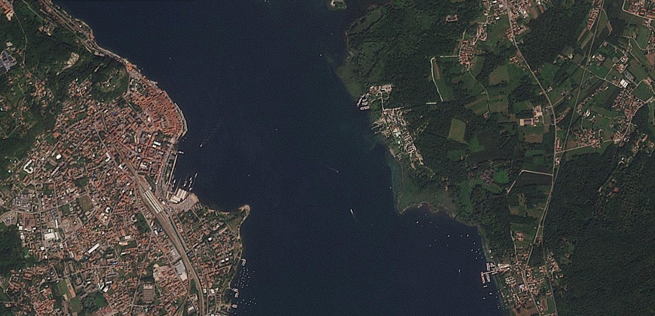
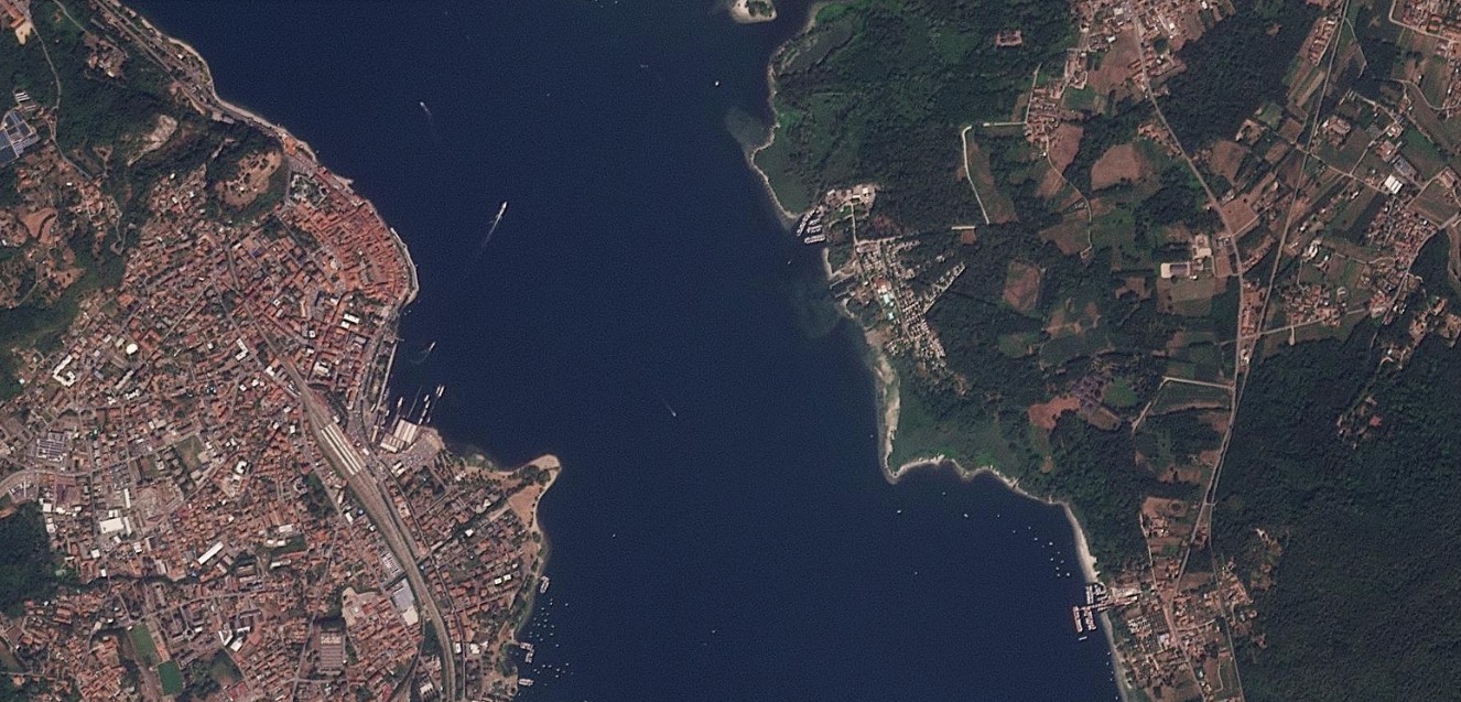
Figure 2 — Arona, 13 August 2025 / 12 August 2026. The shore of Lake Maggiore at Arona, with the Rocca promontory and the entrance to the Borromeo gulf. The lake, which regulates part of the Po’s flow in the summer months, is classified by the Po basin authority as being in extreme drought for the period, based on stored water volumes. Source: Planet Labs PBC.
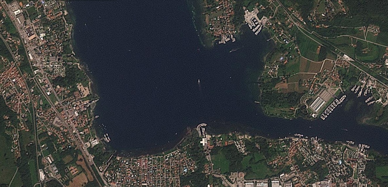
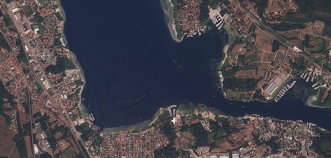
Figure 3 — Arona, detail, 13 August 2025 / 12 August 2026. A close-up view of Arona’s urban shoreline. The comparison reveals a wider strip of exposed shoreline in 2026, consistent with the below-average lake level reported by the basin authority. Source: Planet Labs PBC.
The Po at Turin and in the Vercelli area
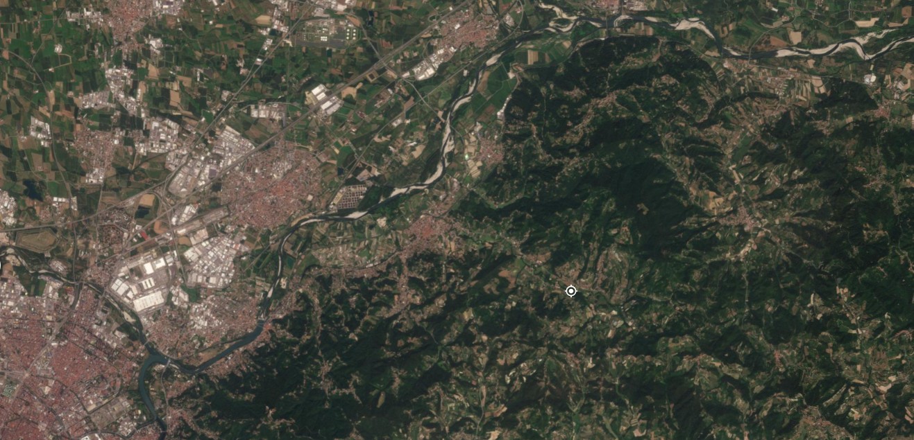
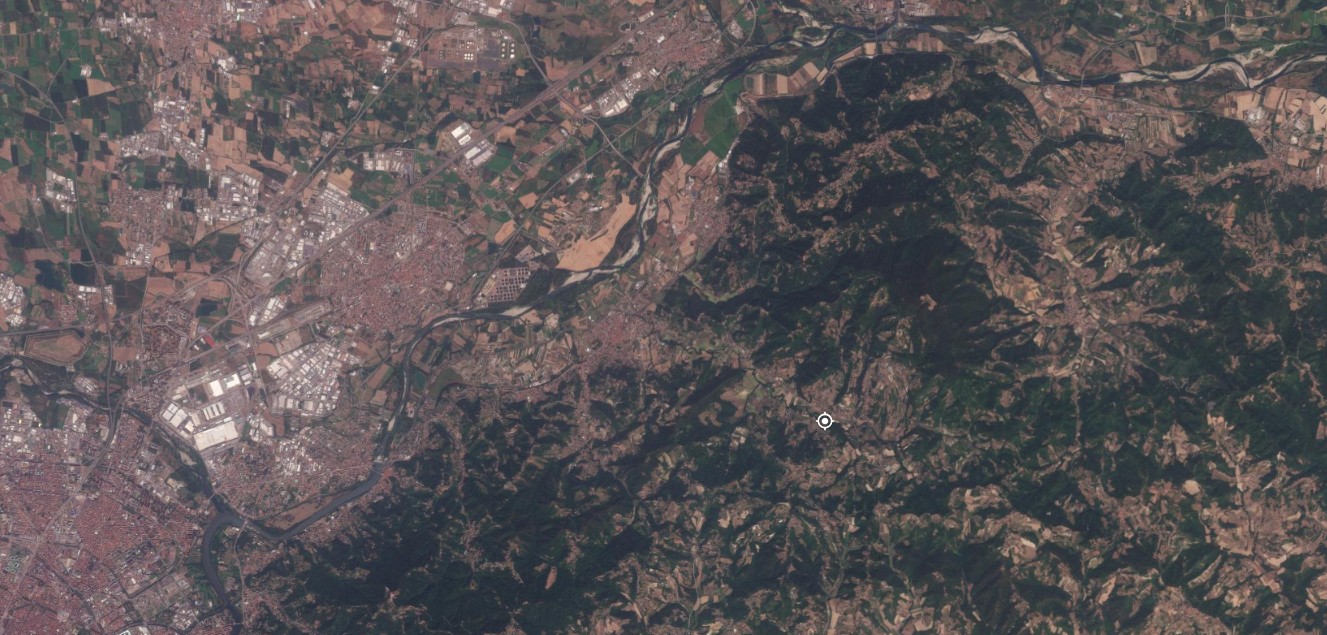
Figure 4 — Turin, 13 August 2025 / 12 August 2026. The stretch of the Po that runs through Turin, near the Murazzi. Since late May 2026 the river has hosted an abnormal proliferation of algae and aquatic plants, encouraged by lower water levels and warmer water; between June and July the city removed more than 200 tonnes of vegetation without solving the problem. Source: Planet Labs PBC.
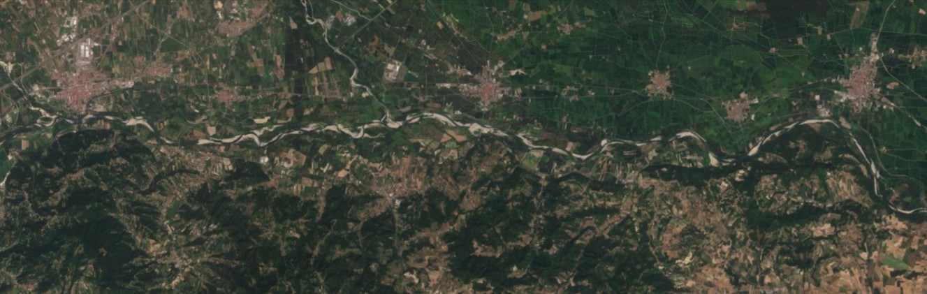
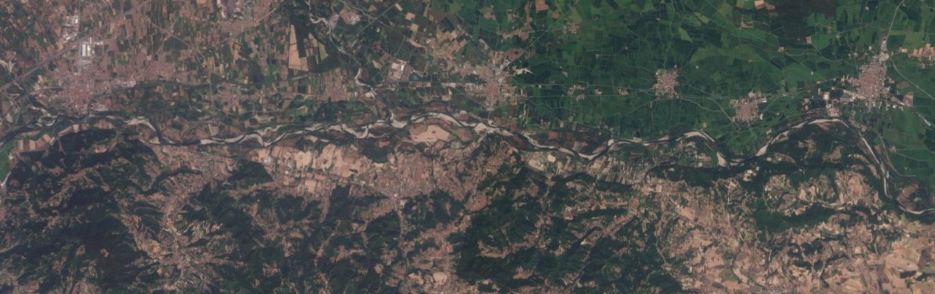
Figure 5 — Crescentino, 13 August 2025 / 12 August 2026. A broad meander of the Po in the Vercelli stretch. The sand and gravel bars exposed along the banks occupy a visibly larger portion of the riverbed in 2026 than in 2025, in line with the below-normal flow rates reported in the district bulletin. Source: Planet Labs PBC.
The Sesia and the rice paddies
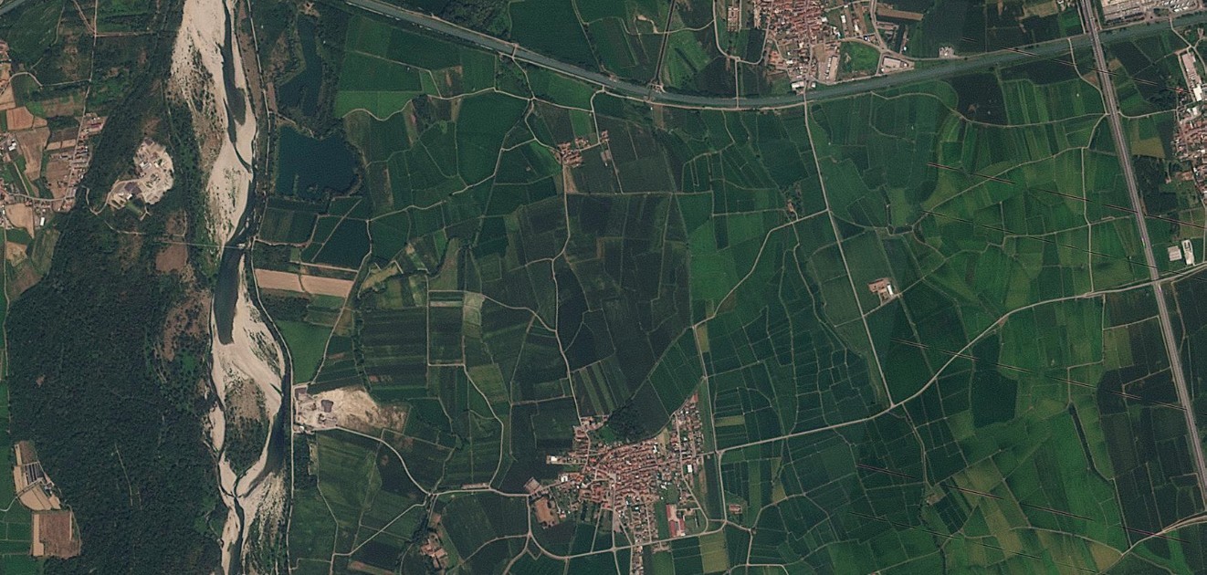
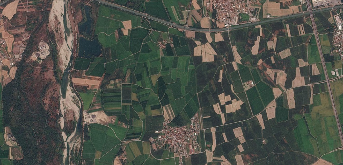
Figure 6 — Biandrate, Sesia, 12 August 2025 / 12 August 2026. The Sesia river, a tributary of the Po, with the Vercelli rice paddies on its eastern bank. The gravel bed is wider and more exposed in 2026; several fields that in 2025 appeared flooded for rice cultivation instead appear brown and dry, consistent with the irrigation difficulties reported this summer by the Est Sesia consortium. Source: Planet Labs PBC.
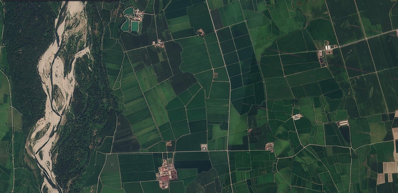
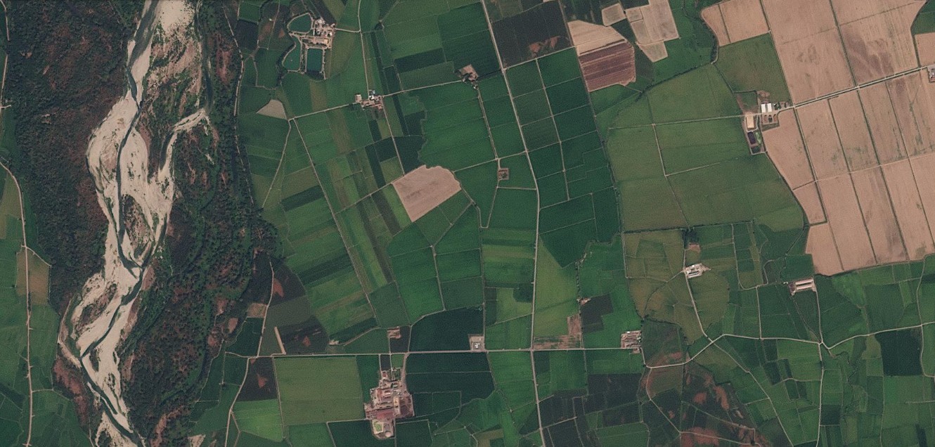
Figure 7 — Biandrate, Sesia, second point, 12 August 2025 / 12 August 2026. A second point along the Sesia, a little farther downstream. The comparison shows the same pattern: more extensive gravel bars in the riverbed and fields that turn from green to brown between the two years. Source: Planet Labs PBC.
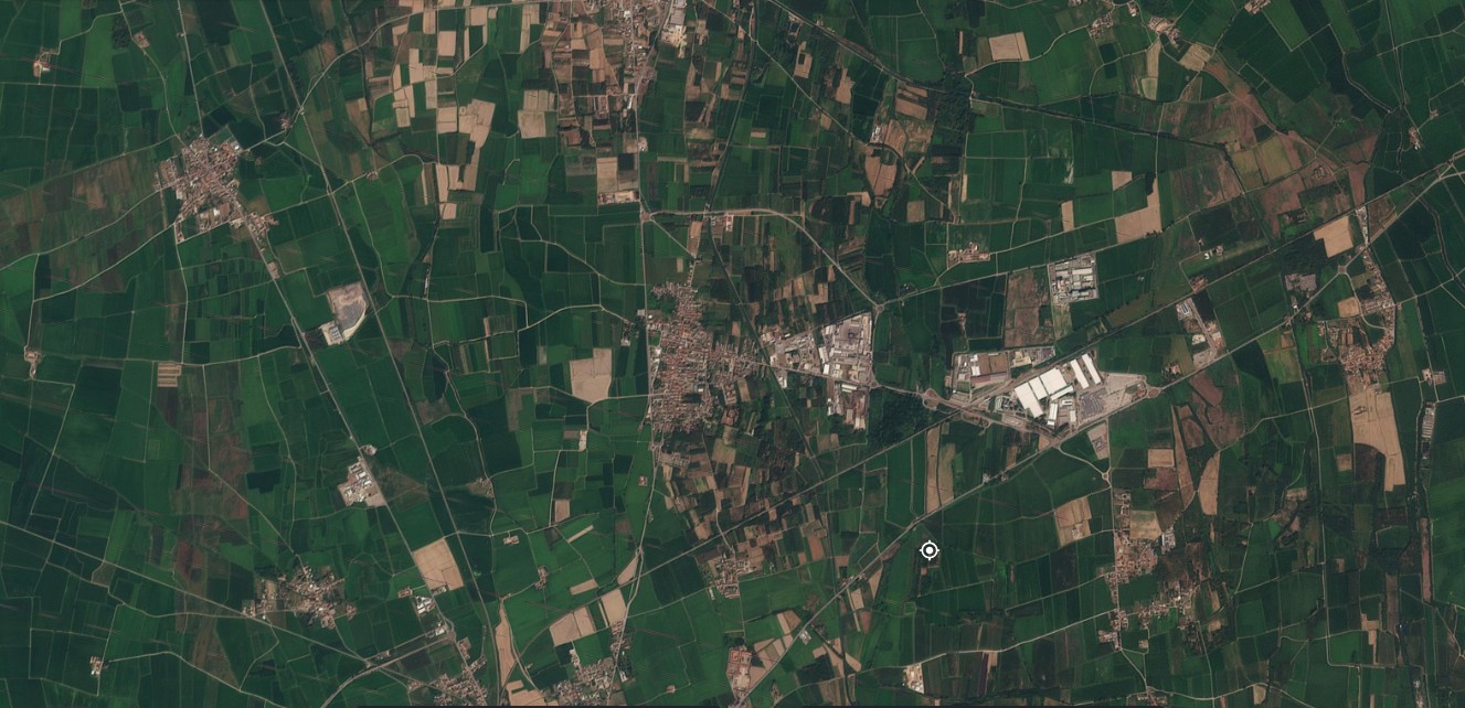
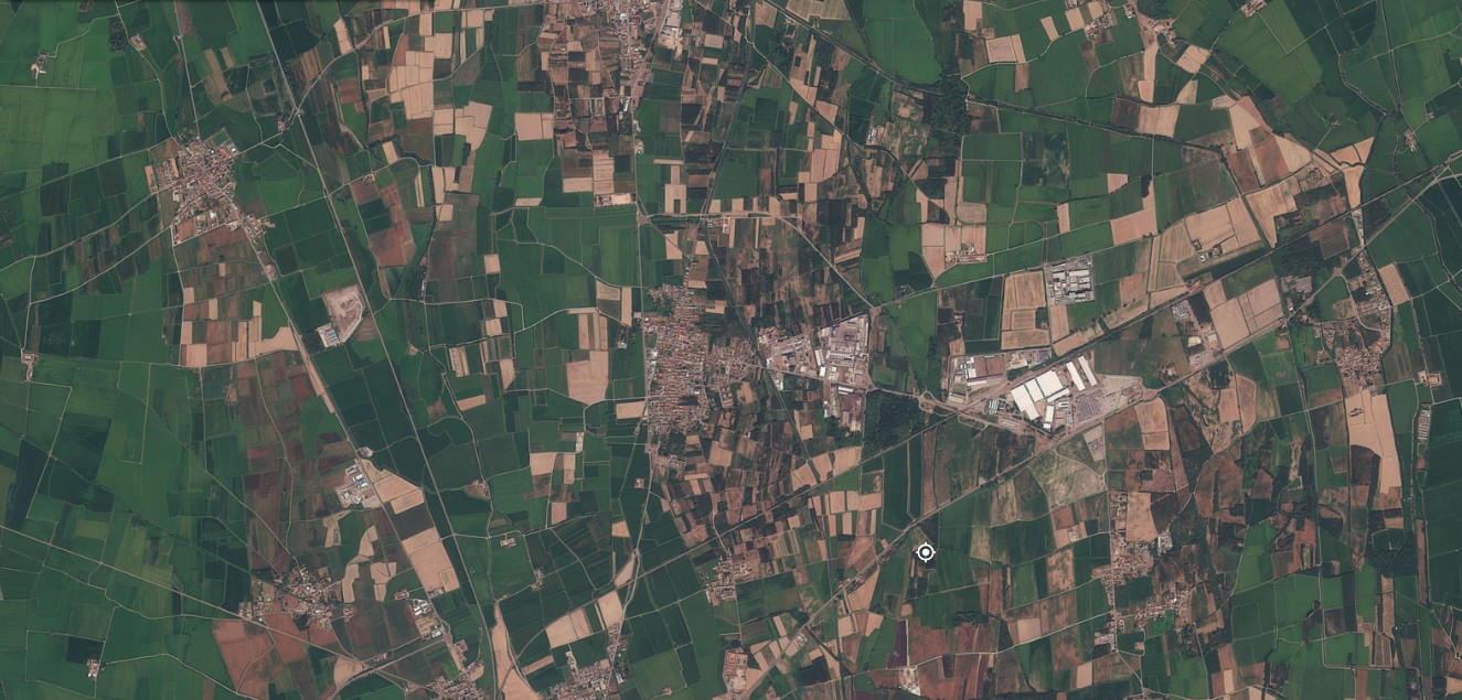
Figure 8 — Mortara, 12 August 2025 / 12 August 2026. The rice-growing area of the Lomellina, in the province of Pavia, where much of Italy’s rice production is concentrated. In 2026 wider stretches of fields appear brown instead of the uniform green of flooded paddies: according to Confagricoltura Pavia, the season could cost the local sector more than 100 million euros. Source: Planet Labs PBC.
The middle Po
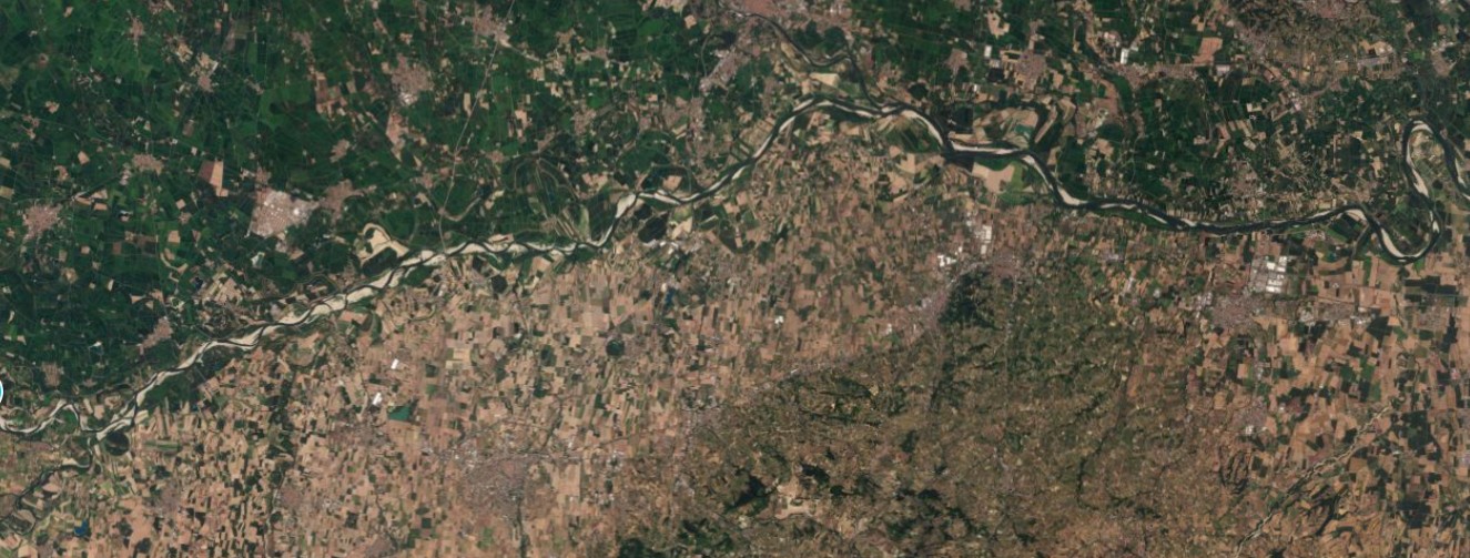
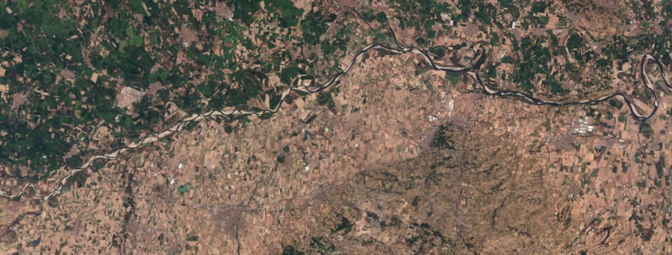
Figure 9 — Pavia, 9 August 2025 / 9 August 2026. The confluence of the Ticino into the Po, near Pavia. The sandbars exposed in the Po’s riverbed are far more extensive in 2026, and the surrounding countryside appears overall drier than on the same day in August 2025. Source: Planet Labs PBC.
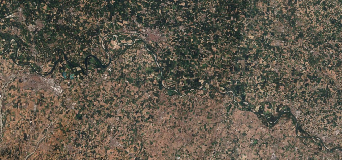
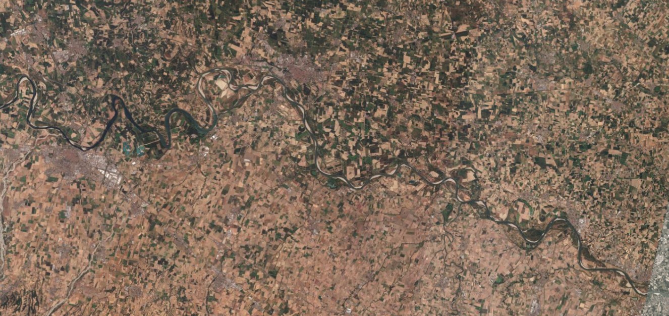
Figure 10 — Cremona, 9 August 2025 / 10 August 2026. The Po in the Cremona stretch. This is one of two sections, along with Borgoforte, for which the basin authority’s bulletin of 13 August 2026 reports “extreme drought” conditions based on the thirty-day SFI index. Source: Planet Labs PBC.
The lower Po and the delta
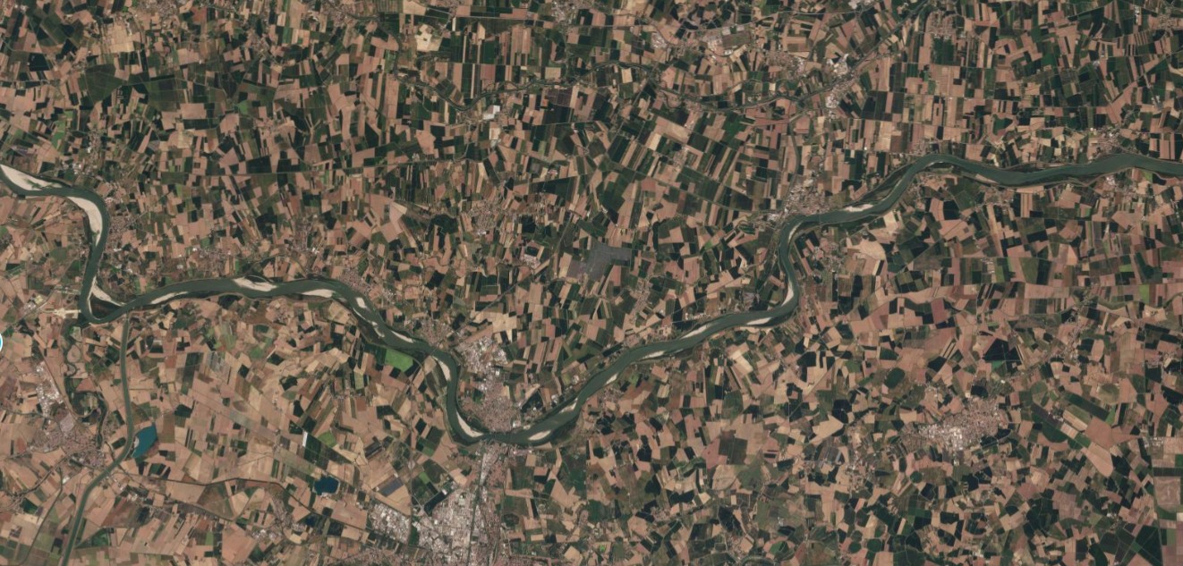
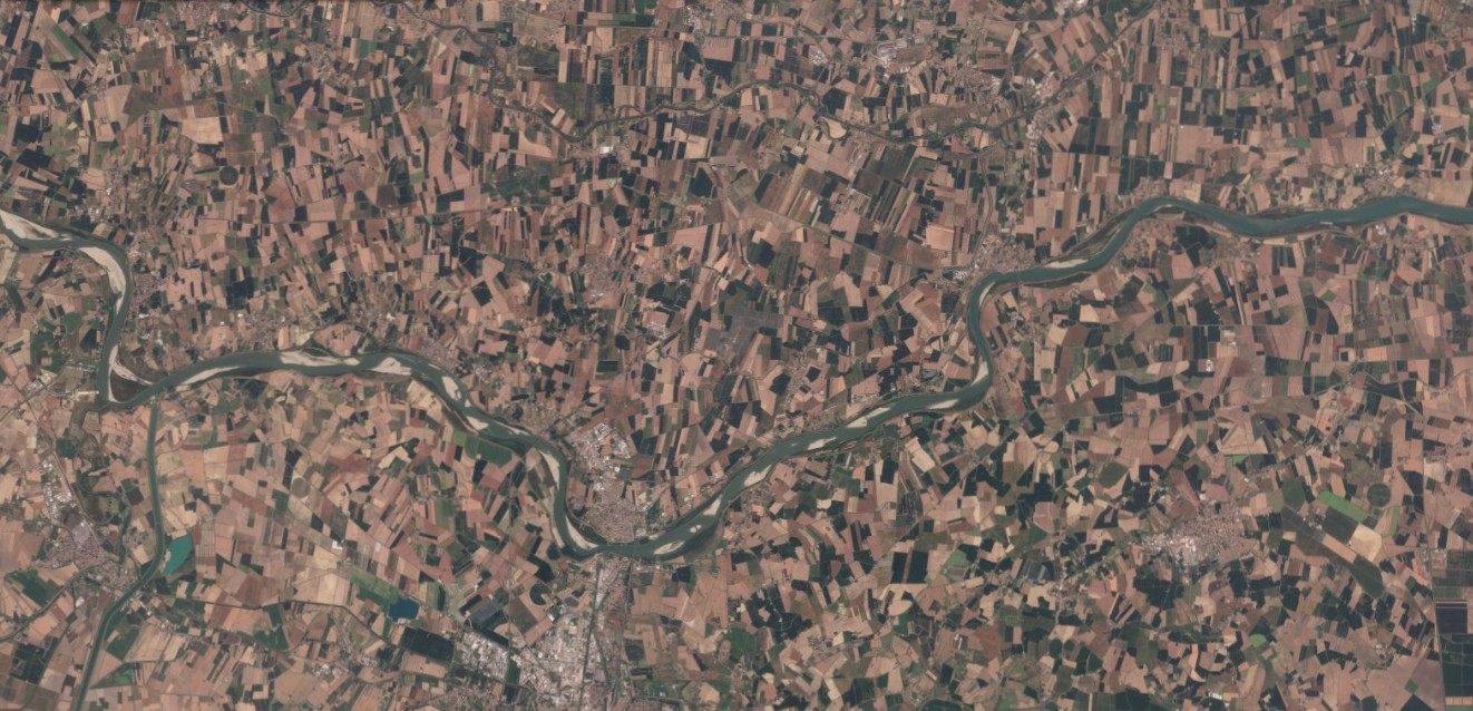
Figure 11 — Santa Maria Maddalena, 11 August 2025 / 11 August 2026. The Po in its lower course, on the border between Veneto and Emilia-Romagna. Here too the riverbed shows wider, more extensive sandbars in 2026, a sign of a reduction in flow that propagates downstream all the way to the delta. Source: Planet Labs PBC.
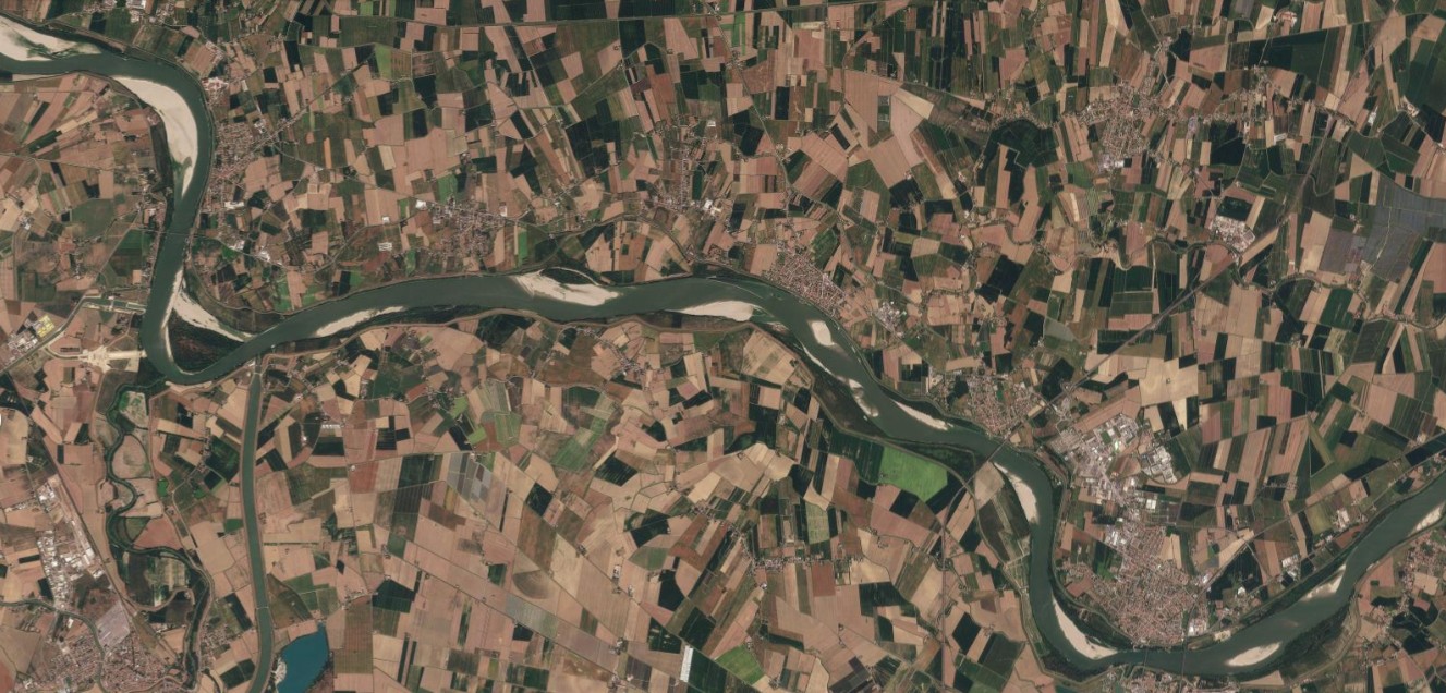
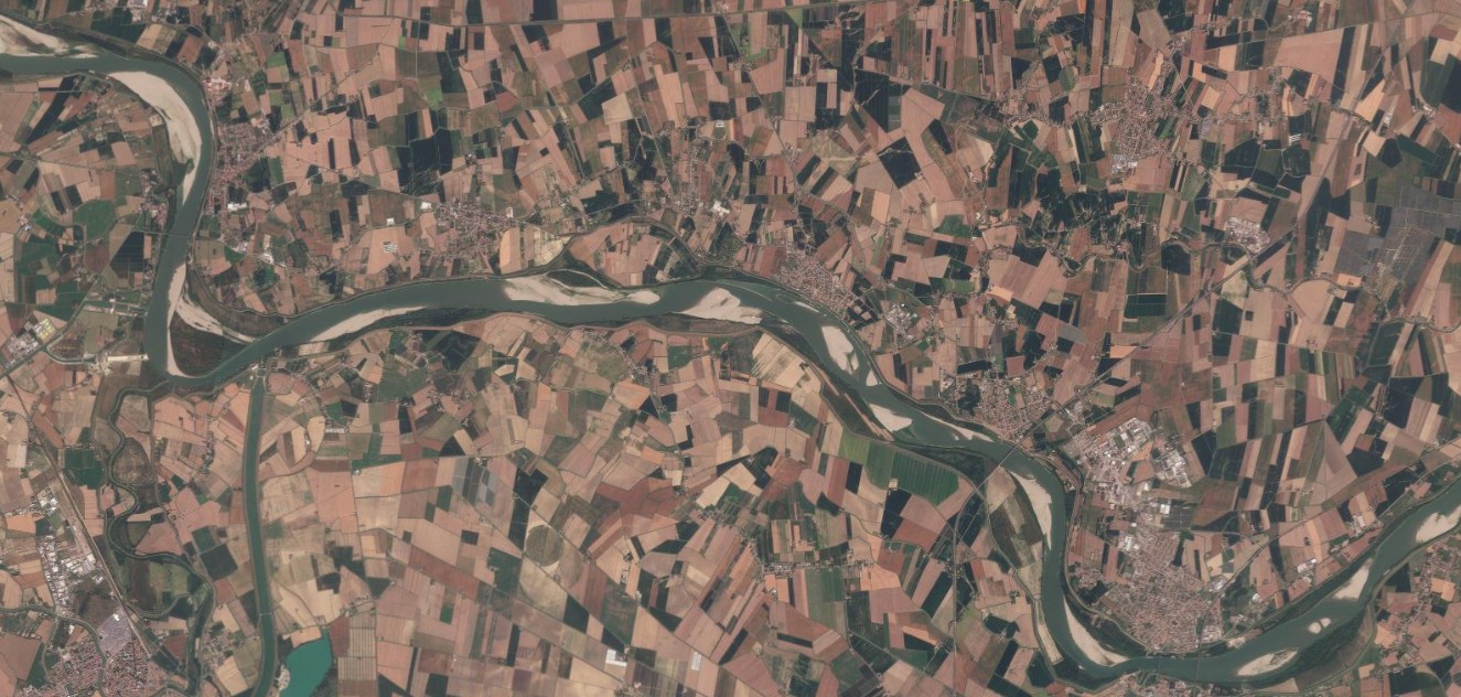
Figure 12 — Santa Maria Maddalena, detail, 11 August 2025 / 11 August 2026. A close-up view of the same stretch of the lower Po. The comparison highlights the difference in the width of the active water channel between the two dates. Source: Planet Labs PBC.
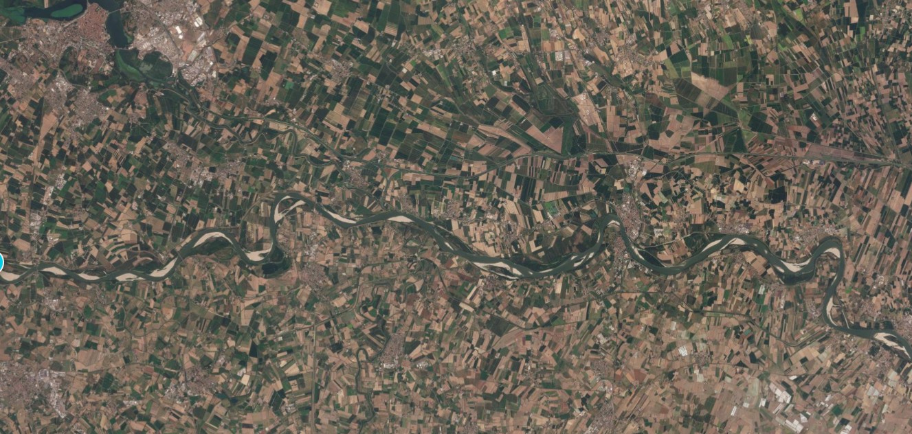
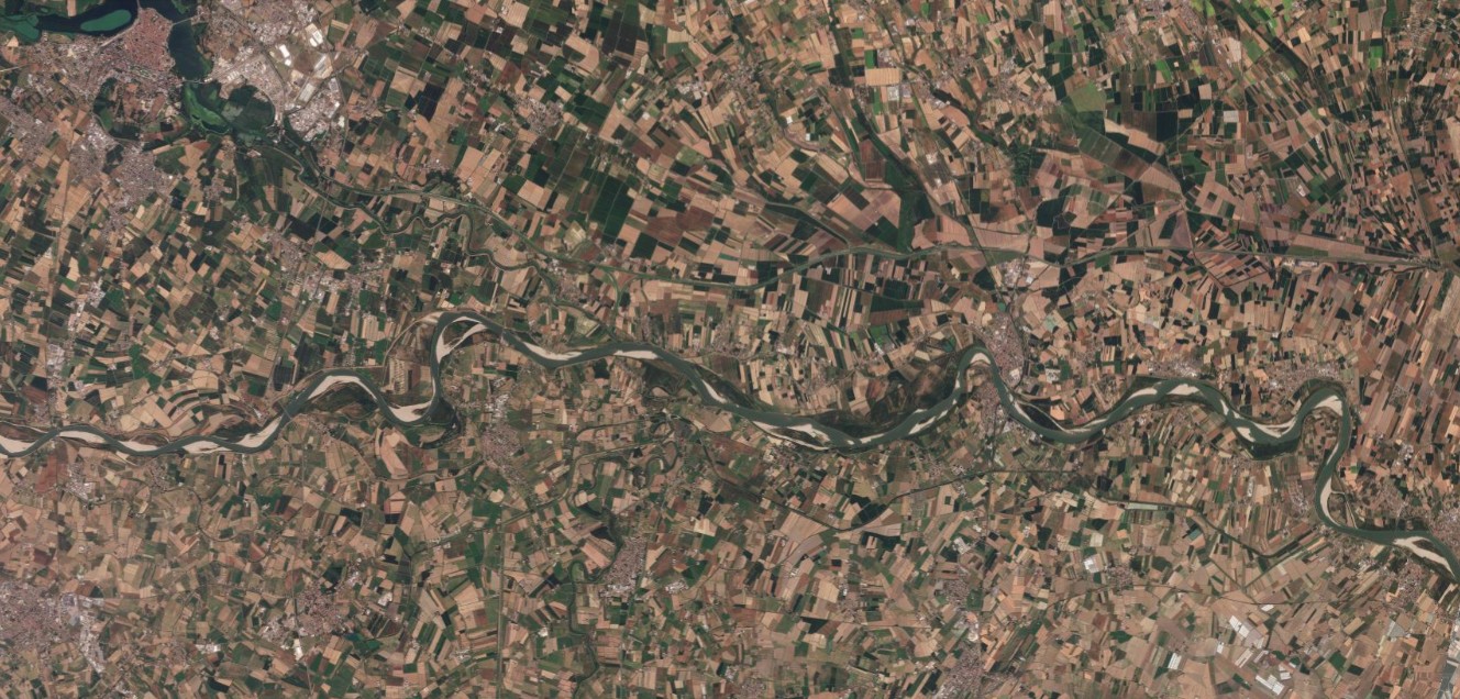
Figure 13 — Mantua, 13 August 2025 / 13 August 2026. The Po in the Mantua area. The sandy shoals visible in 2026 significantly narrow the navigable channel compared with 2025. Source: Planet Labs PBC.
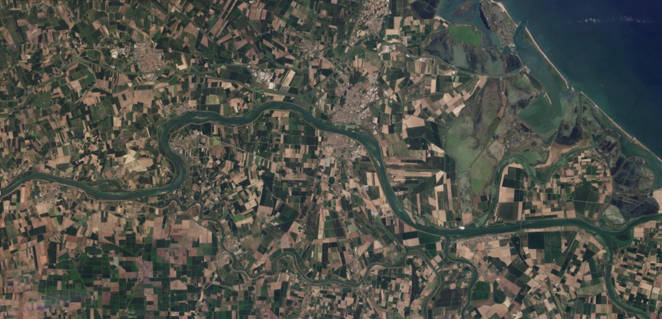
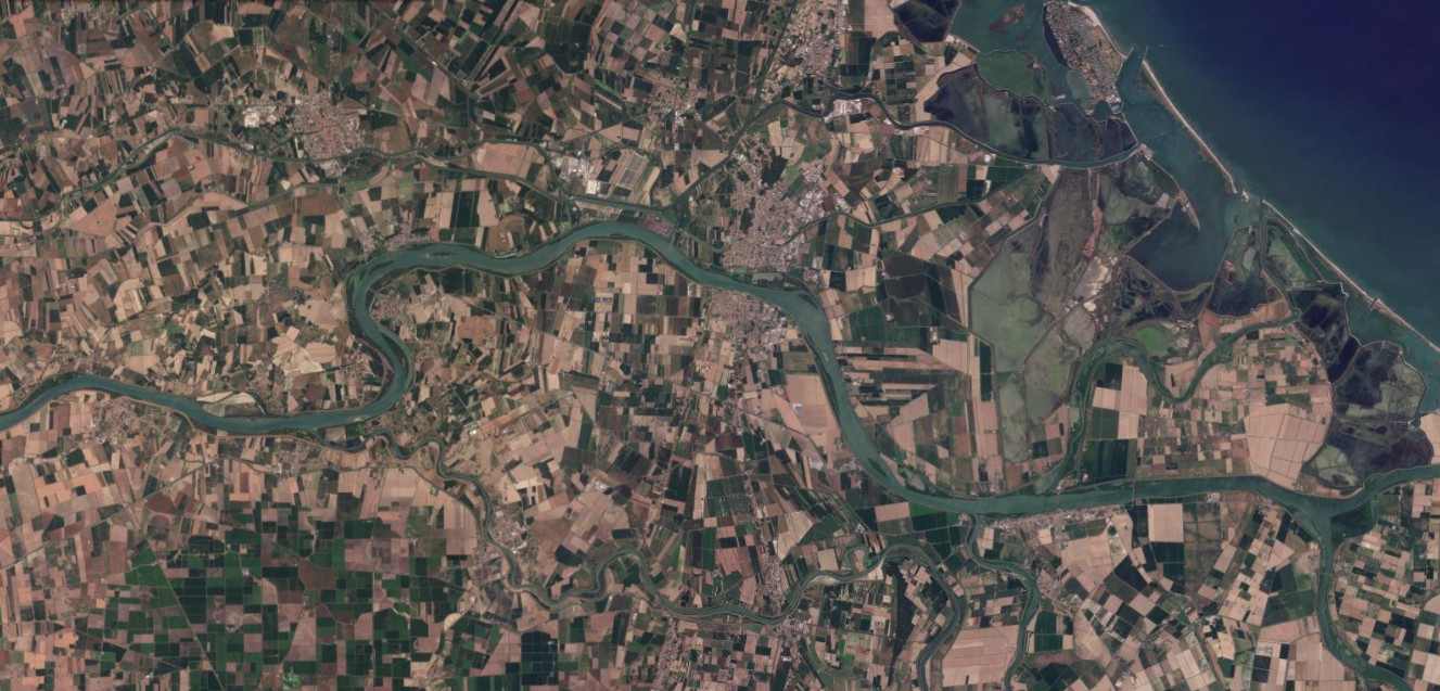
Figure 14 — Po Delta, 14 August 2025 / 13 August 2026. The mouth of the Po, with its coastal lagoons. For weeks the basin authority has reported a persistent saltwater intrusion in this stretch, making it difficult or impossible to draw fresh water for irrigation: on 12 August 2026 the flow rate at Pontelagoscuro, just upstream, was 233 cubic metres per second, against a critical threshold of 450. Source: Planet Labs PBC.
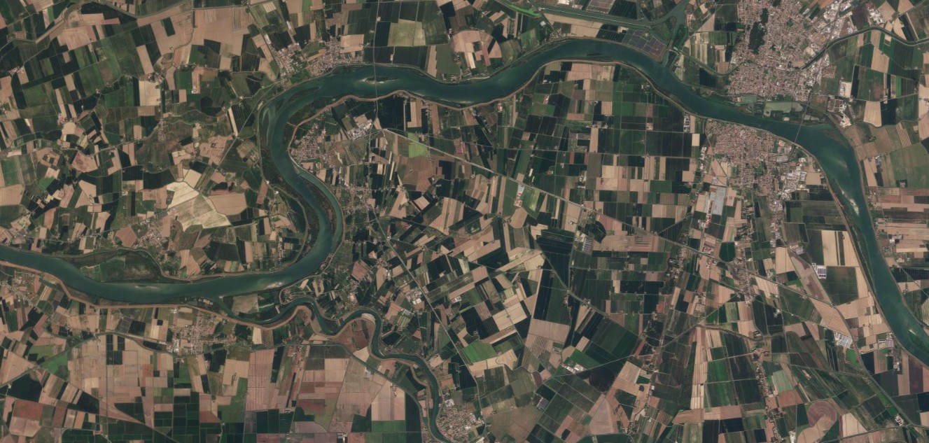
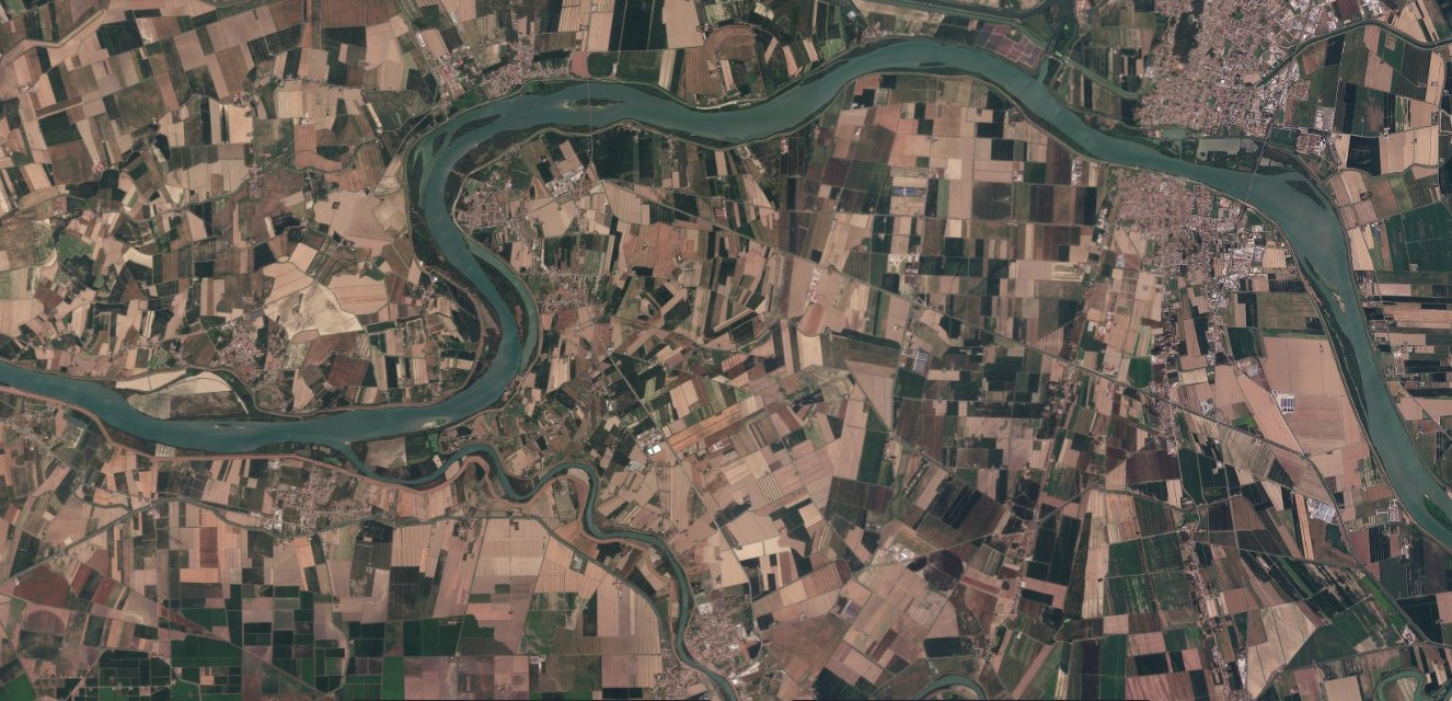
Figure 15 — Po Delta, detail, 14 August 2025 / 13 August 2026. A detail of a bend in the delta. Even at this scale, the surrounding countryside can be seen to be drier than in the same period of 2025. Source: Planet Labs PBC.
Sources: Po river district basin authority, Weekly hydrological situation update (13 August 2026) and Permanent Observatory on Water Uses (6 August 2026); Copernicus European Drought Observatory and the European Commission’s Joint Research Centre (12 August 2026); ARPA Piemonte, data cited by Il Post (11 August 2026); ARPA Valle d’Aosta, data cited by Nos Alpes (20 July 2026); Reuters, “Drought scorches Italy’s rice belt as water supplies hit record lows” (10 August 2026).