The Black Sea Stronghold
Crimea, twelve years after the annexation: what has changed on the peninsula, between Russian construction sites, Ukrainian strikes and new coastal defenses
Work in progress · 4 May 2026
When Russia formally annexed Crimea on 18 March 2014, the peninsula was a tourist destination with a Soviet-era legacy and one large naval base. Twelve years later, it is one of the most militarized and most heavily struck territories on the European continent. Almost everything we know about how it looks today comes from orbit: no one enters the island freely — because Crimea has, in effect, become a political island — and local documentation is filtered through a Russian propaganda apparatus that leaves no room for independent verification. High-resolution commercial satellites, in particular Planet’s SkySat and Pelican fleets, have photographed every significant development over the past twelve years: construction sites, strikes, rebuilding efforts, new defenses. What follows is an atlas in thirteen images.
The bridge
The Crimean Bridge across the Kerch Strait, completed in 2018, is the physical symbol of the annexation: nineteen kilometers of road and rail deck linking the peninsula to the Russian mainland at Krasnodar. It has been attacked twice. The first strike came on 8 October 2022, attributed to Ukrainian intelligence, and destroyed two road spans while severely damaging the rail section. The second, on 17 July 2023, hit the road side using Ukrainian naval drones.
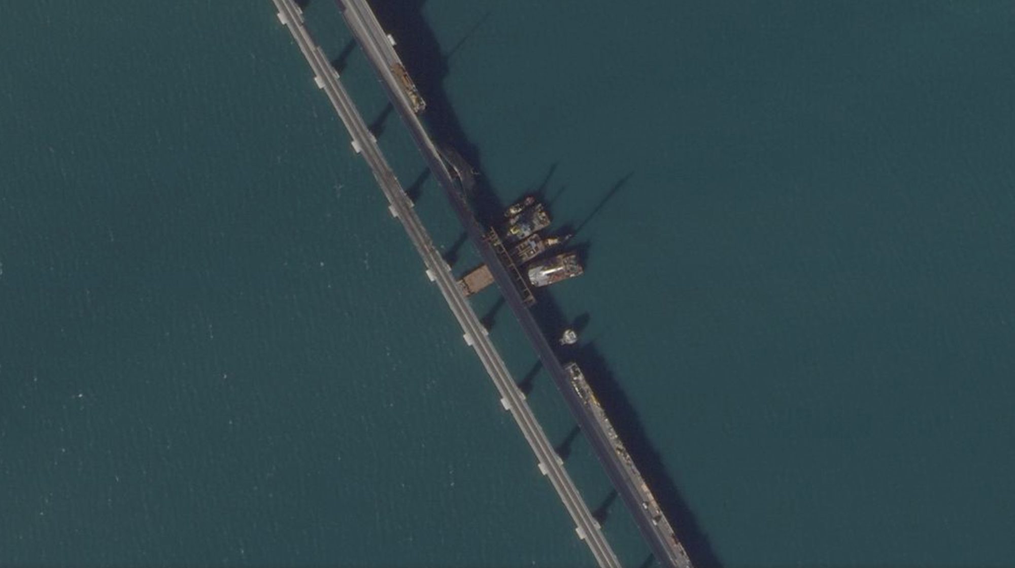
Figure 1 — Kerch Bridge, 27 October 2022, three weeks after the first attack. The damaged road section is visible, along with the emergency construction work under way to restore traffic. Source: Planet SkySat.
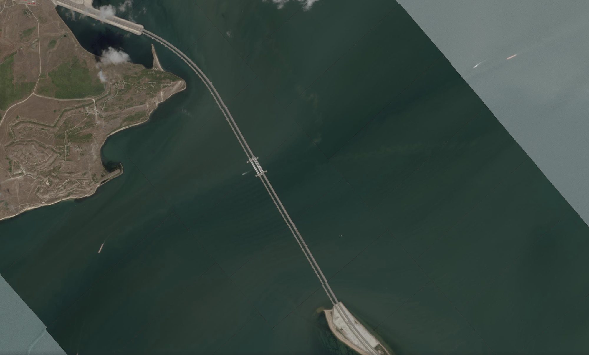
Figure 2 — Same sector, 13 August 2023, less than a month after the second attack. The dual carriageway is again broken on the right-hand side: the stumps of the fallen spans are visible, along with the start of the second reconstruction campaign. Source: Planet SkySat.
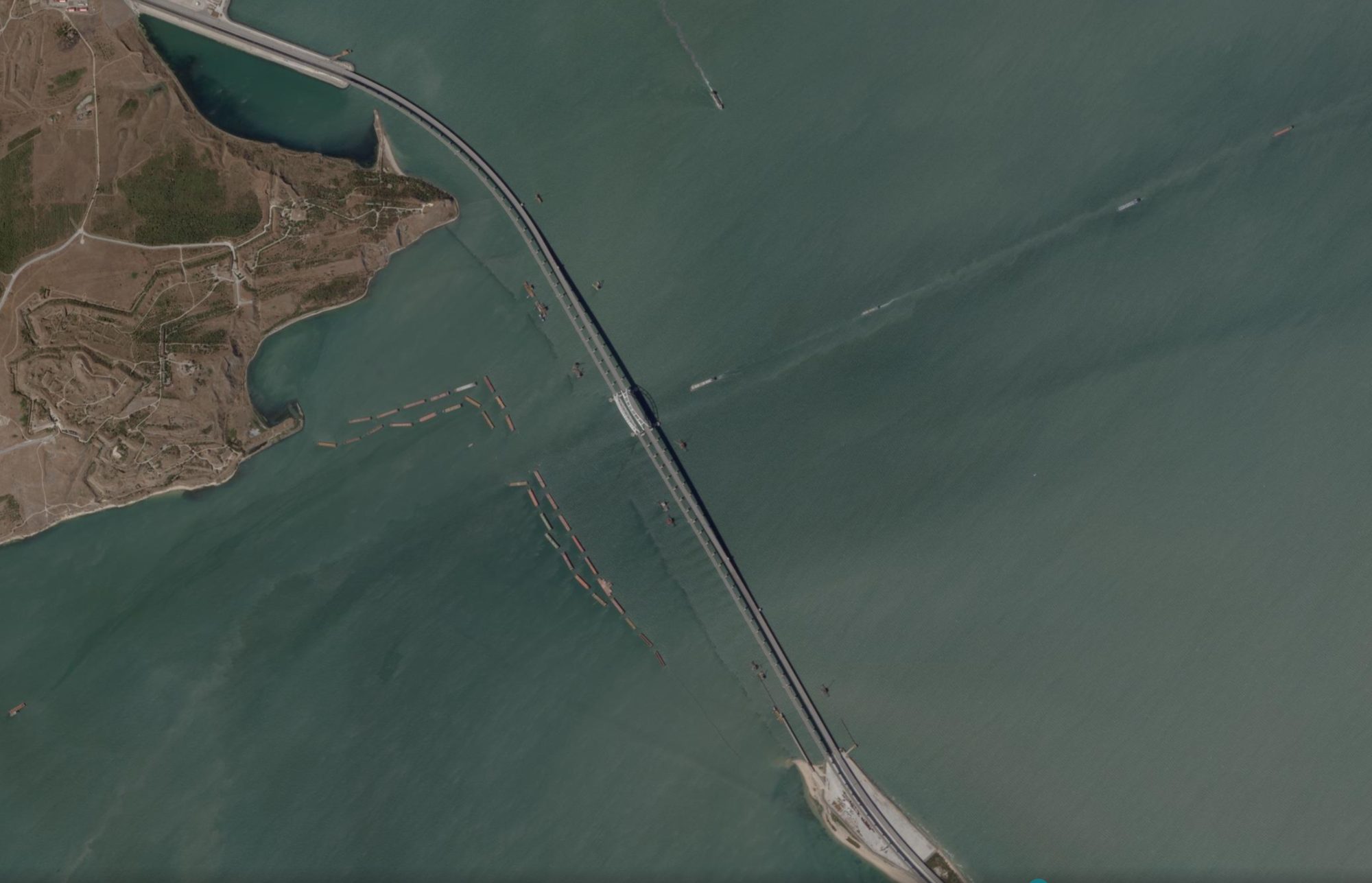
Figure 3 — A year later, 18 August 2024, the bridge is intact again. In the water around the piers, lines of barges and floating obstacles are visible, part of an anti-naval-drone protection system installed in 2024. Source: Planet SkySat.
The naval base
For nearly two and a half centuries, Sevastopol has been the main base of the Russian Black Sea Fleet. After the sinking of the cruiser Moskva in April 2022 and the missile strike on the Black Sea Fleet headquarters in September 2023, Russia progressively moved a significant share of its surface units to Novorossiysk, on Russia’s eastern Black Sea coast. Sevastopol nonetheless remains the peninsula’s most important military port, and the evolution of its naval presence is one of the clearest indicators of the state of the conflict.
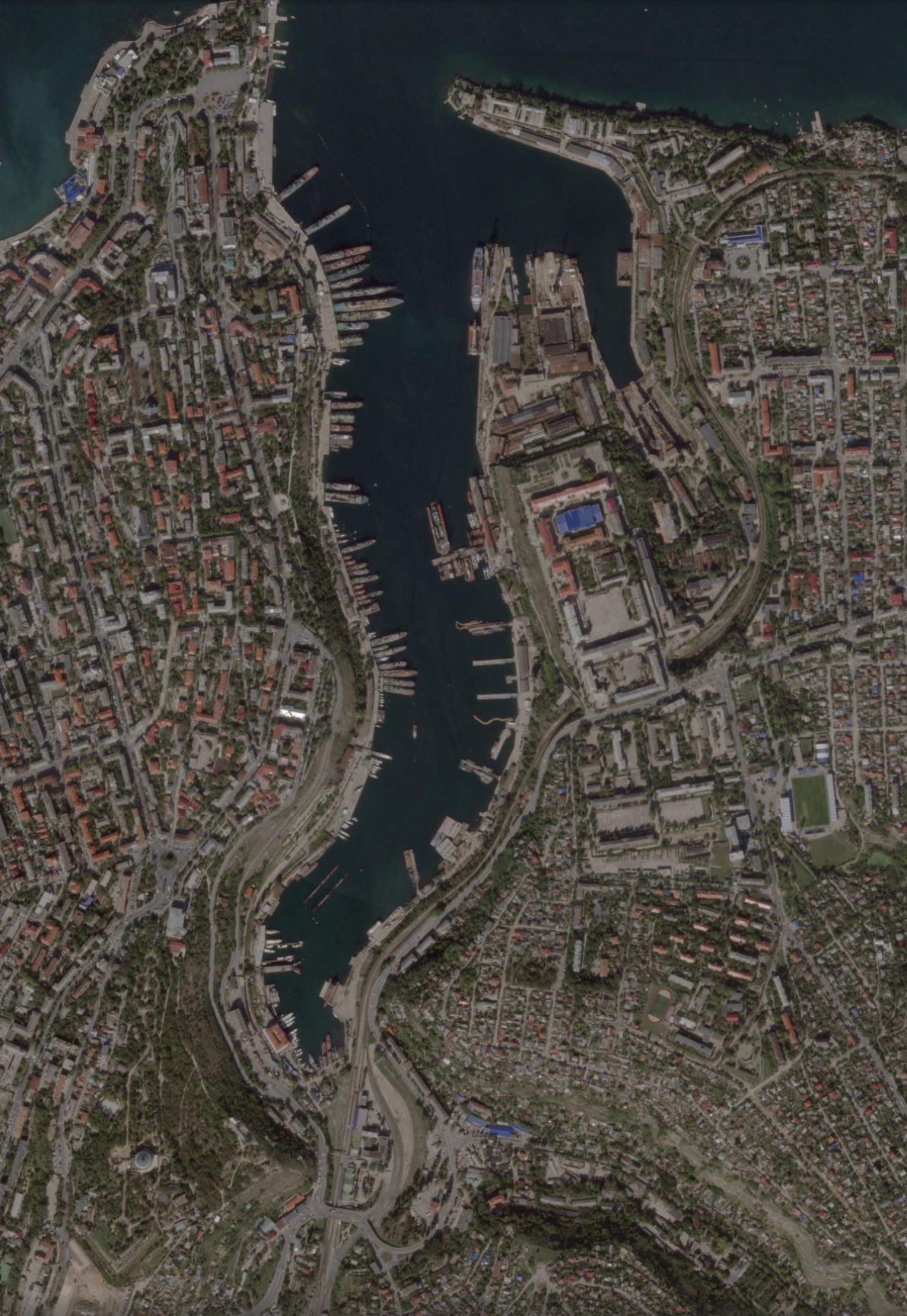
Figure 4 — Sevastopol, 4 October 2022, six months after the sinking of the Moskva. The military harbor is still densely packed with surface units. Source: Planet Labs.
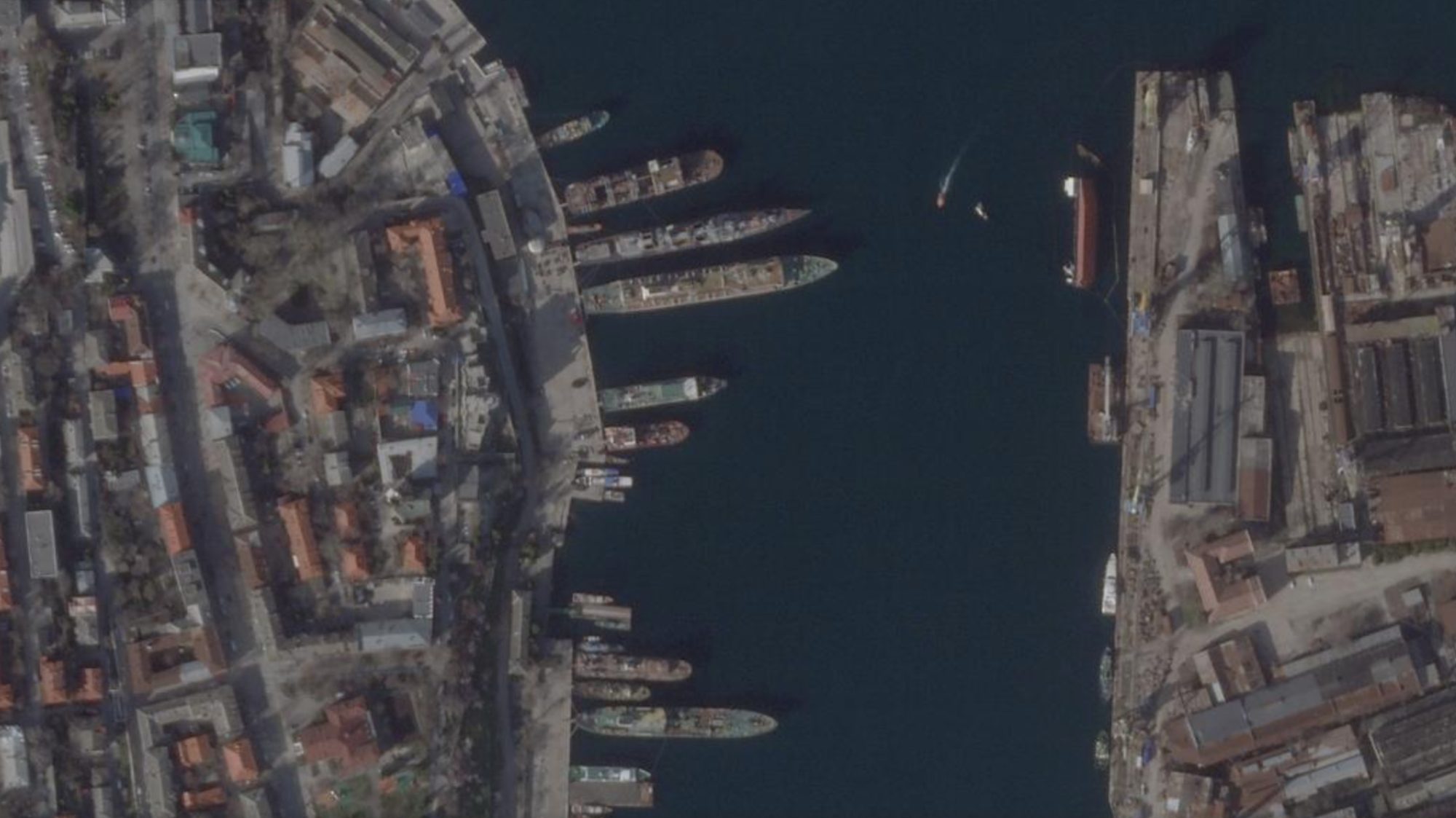
Figure 5 — Sevastopol, 2 April 2026. The naval presence appears significantly reduced. A portion of the larger units has been relocated to Novorossiysk following the 2023-2024 campaign of Ukrainian missile and naval-drone strikes. Source: Planet Labs.
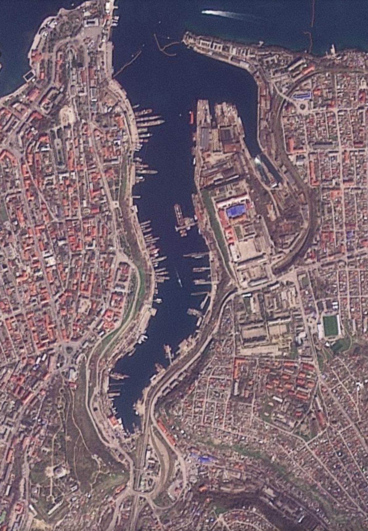
Figure 6 — Same sector, 3 April 2026, twenty-four hours later. The one-day comparison makes it possible to track the operational pattern: auxiliary vessels entering and leaving, the positioning of floating pontoons, and possible relocation of sensitive assets after nighttime alerts. This is the kind of tactical reading that daily SkySat-Pelican tasking makes possible. Source: Planet Labs.
The airbases hit
On 9 August 2022, a series of explosions devastated the naval air base at Saky, on Crimea’s western coast. It was the first visible demonstration, even to international public opinion, that the war had reached annexed territory. At least a dozen aircraft — including Su-24s, Su-30s and Be-12s — were destroyed.
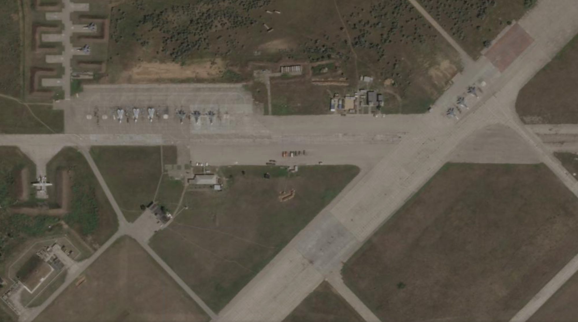
Figure 7 — Saky airbase, 9 August 2022, the same day as the attack. Aircraft can be seen parked in regular positions on their hardstands, before the afternoon’s explosions. Source: Planet Labs.
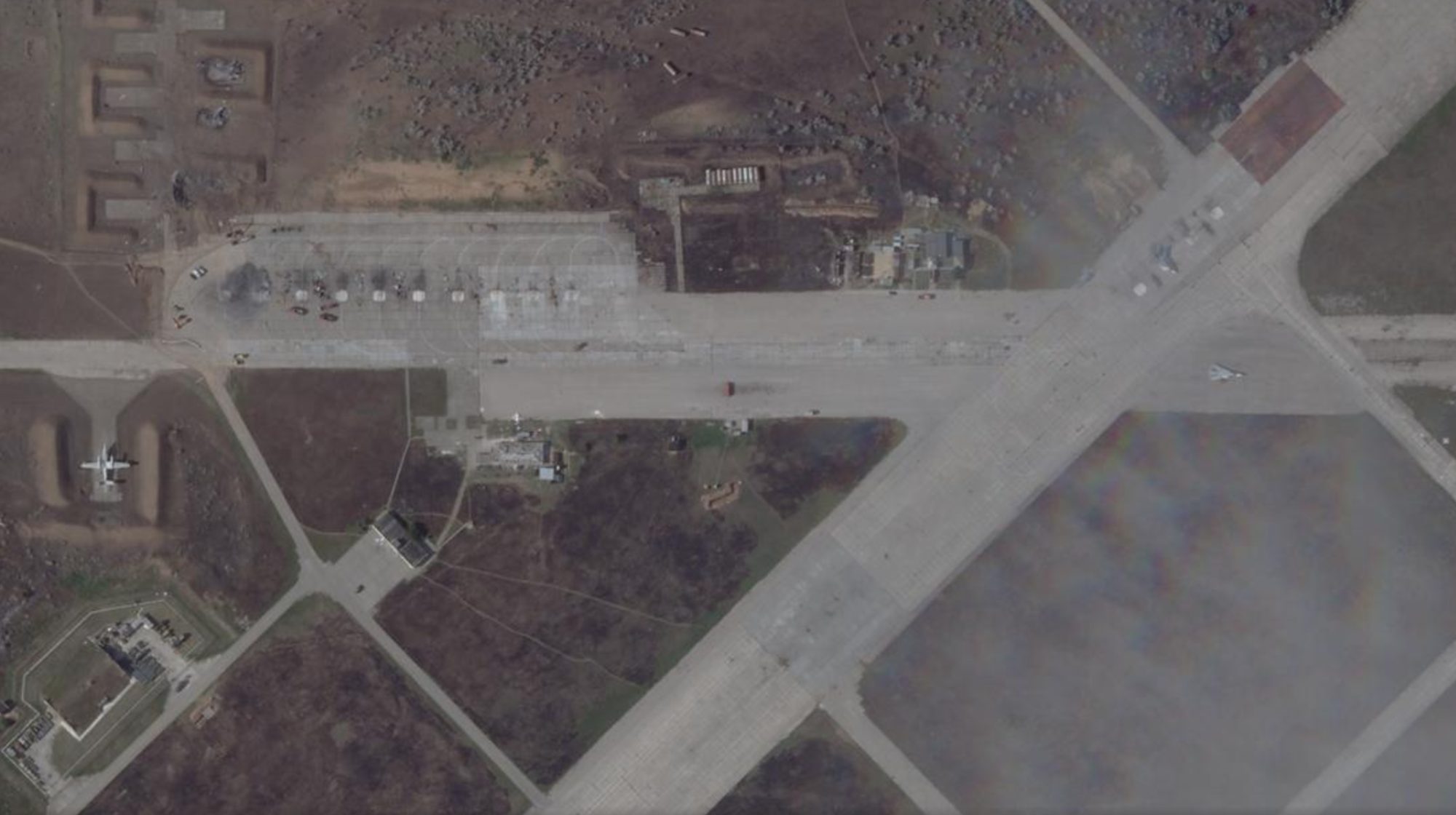
Figure 8 — Same sector, 10 August 2022, twenty-four hours later. Visible are craters on the apron, the wreckage of destroyed aircraft, fire scorching on the concrete, and the absence of most of the aircraft previously present. Source: Planet Labs.
Nearly two years later, on 17 April 2024, Ukrainian forces struck Dzhankoy airbase in the north of the peninsula with US-supplied ATACMS tactical missiles, destroying an undisclosed number of Mi-8 helicopters and S-400 air-defense batteries.
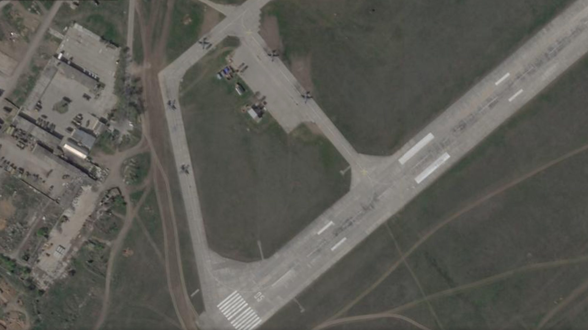
Figure 9 — Dzhankoy, 19 April 2024, two days after the ATACMS strike. Damaged structures and fire scorching are visible on the apron, consistent with the destruction of parked helicopters and an air-defense position. Source: Planet Labs.
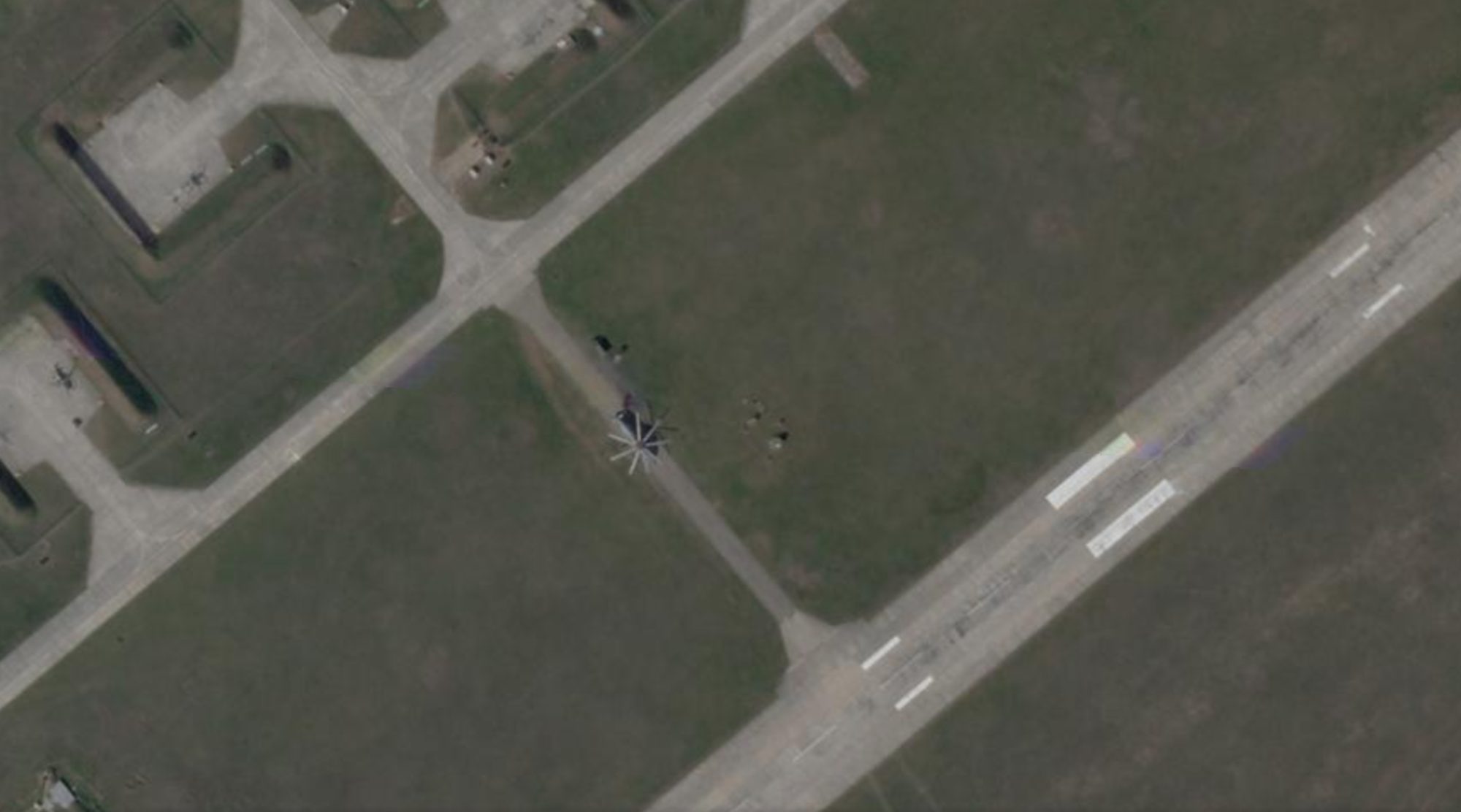
Figure 10 — Alternative view of the same site on the same day. The detail shows the scattered pattern of damaged areas and the absence of assets that, until a few weeks earlier, had been regularly parked in the sector. Source: Planet Labs.
Air defense
Following the 2022-2024 strikes, Russia deployed one of the densest air-defense systems on the entire front in Crimea: S-400 and S-300 batteries along the coasts, mobile Pantsir and Buk systems covering the bases, and long-range radar. The logic is to protect the peninsula’s western flank from further missile strikes and long-range drone incursions.
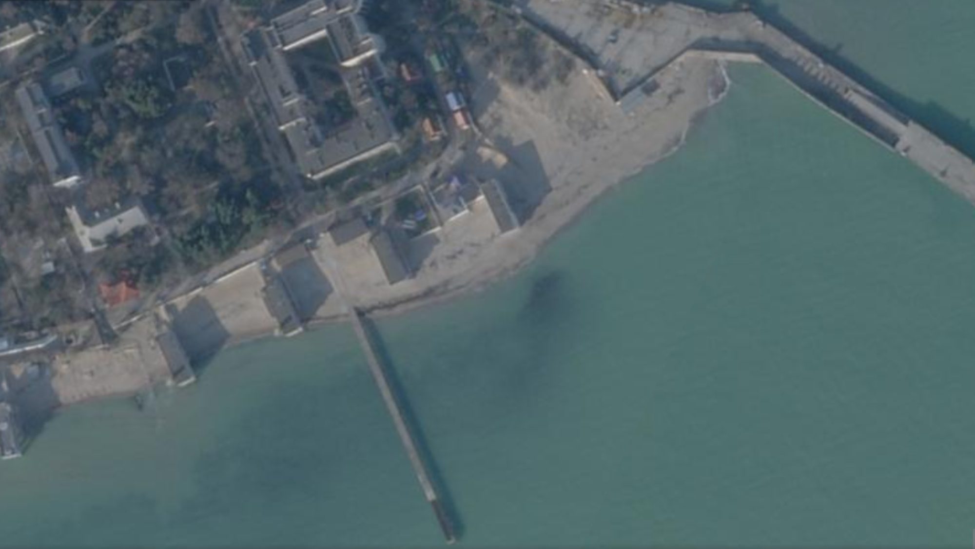
Figure 11 — Yevpatoria, 21 January 2026. A coastal air-defense position: launchers can be seen in operational configuration, along with generators, personnel stations and camouflage. It is one of the nodes in the S-400 network deployed to protect Crimea’s western flank. Source: Planet Labs.
The dragon’s teeth
Between 2023 and 2025, continuous lines of “dragon’s teeth” — pyramid-shaped concrete blocks, originally developed in the Soviet era to stop armored vehicles — appeared along Crimea’s southern and western coasts, arranged in tight sequences on the beach, often in double or triple rows. These are anti-landing fortifications, sized to obstruct a possible Ukrainian amphibious operation, a scenario considered not remote after the success of several naval-drone operations.
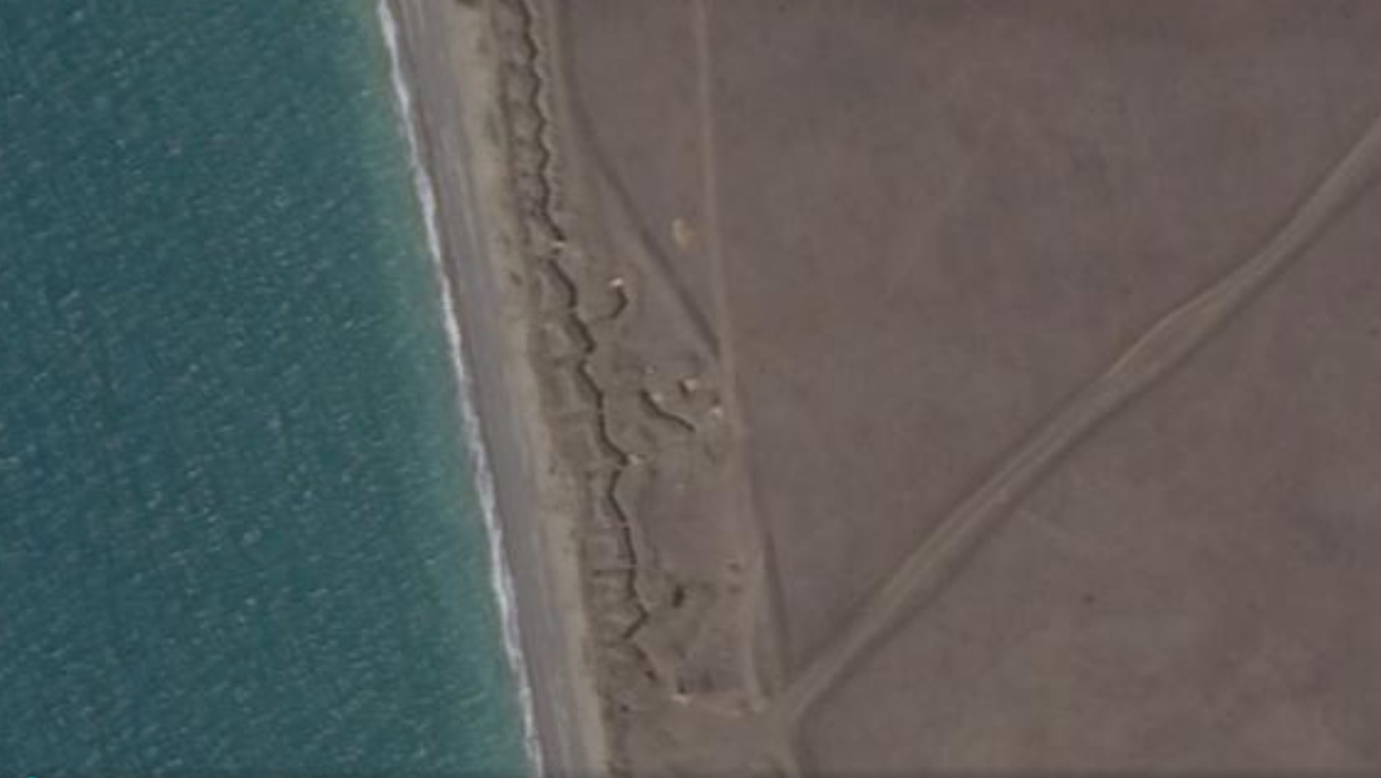
Figure 12 — Crimea’s southwestern coast, 11 August 2024. The lines of dragon’s teeth, recognizable as regular, closely spaced dotting, run parallel to the shoreline for hundreds of meters. Source: Planet Labs.
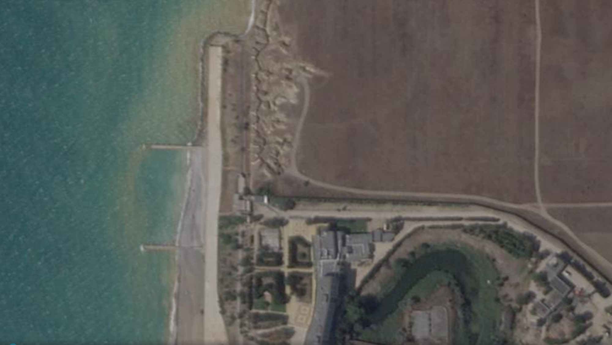
Figure 13 — Adjacent sector, same date. Zigzagging trenches behind the line of dragon’s teeth are visible, along with raised positions for machine guns and observers, completed by service paths for resupplying personnel. Source: Planet Labs.
The stronghold
Thirteen images, five sites, twelve years. The Crimea that emerges from this atlas is not one of a consolidated military occupation, but one of a stronghold in permanent tension: a territory that never stops being built even as it is struck, that produces defenses even as it suffers losses, that changes shape year after year under the eye of commercial satellites. From the ground, twelve years after the annexation, almost no one enters Crimea anymore. From orbit, everything can be seen.