Europe's new radar eyes
What changes with the Next Generation Sentinel-1, and why the continuity of Copernicus radar data is an asset Europe undervalues
Published on Linkiesta · 12 June 2026
At the ILA airshow in Berlin last week, the European Space Agency signed two contracts that most Italian media dismissed in three lines in the space section. Thales Alenia Space will build the satellites. Airbus will build the radar instruments. Together, they will produce the Next Generation Sentinel-1 — successors to the family of radar satellites that has been watching the Earth continuously, free of charge, for anyone who wants to look, since 2014.
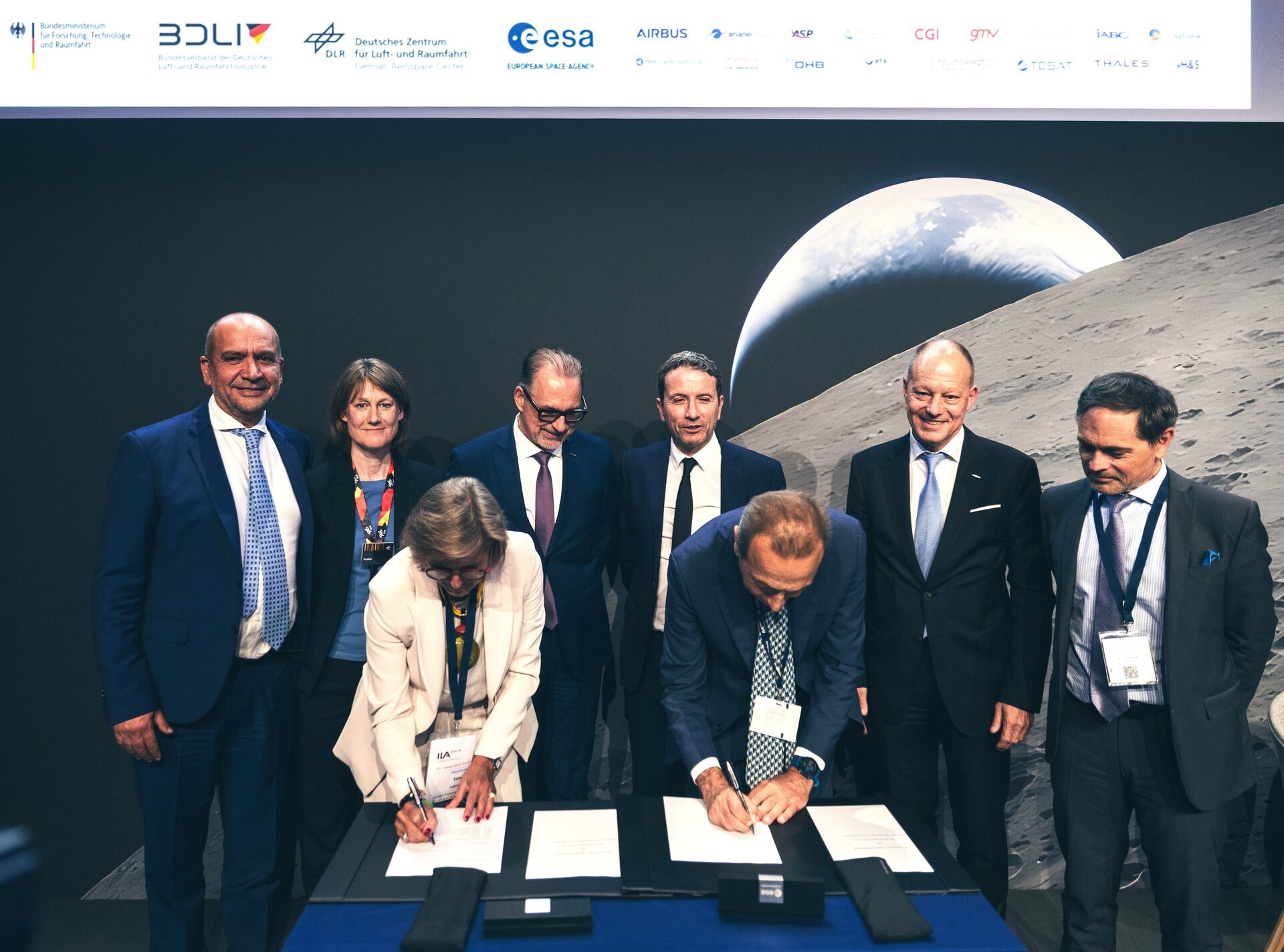
Figure 1 — The signing of the Sentinel-1 Next Generation contract at the ILA Berlin airshow. Credit: ESA – Ph. Servent.
This is not a story only for specialists. Or rather, it is, but it should also matter to people who have never opened a GeoTIFF file in their life. Because these satellites do not observe an abstract planet — they observe the ground beneath our cities, the rivers that cross our plains, the coastlines that are eroding, the landslides that are quietly building up on our mountains.
What a SAR satellite can do that an optical satellite cannot
Before talking about Sentinel-1 NG, it is worth understanding why radar matters. Optical satellites — the ones that produce the color images everyone is familiar with — work like a very sophisticated camera: they need light and a clear sky. At night they see nothing. Under clouds, nothing. In the presence of smoke, nothing.
SAR — Synthetic Aperture Radar — works in a radically different way. It emits a radar signal, measures the time it takes the echo to return, and reconstructs an image of the surface from that measurement. By night as by day. Through clouds, through smoke, in any weather condition. This makes it indispensable for operational monitoring: floods in progress, volcanic eruptions, wildfires in their first hours, when the smoke is still thick.
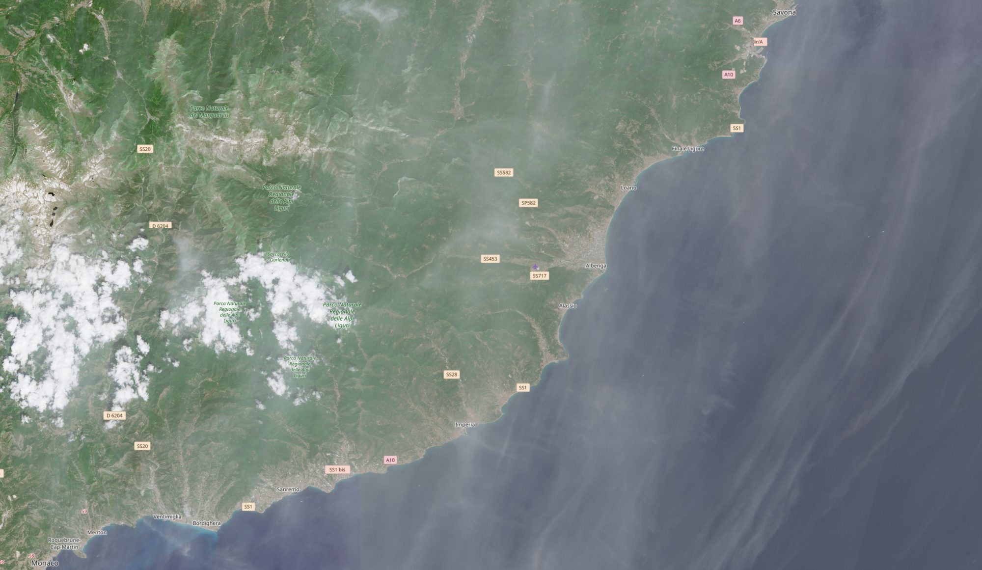
Figure 2 — The coastal area of western Liguria acquired by Sentinel-2 in the optical band: cloud cover hides part of the scene. Source: Copernicus Sentinel-2 / ESA.
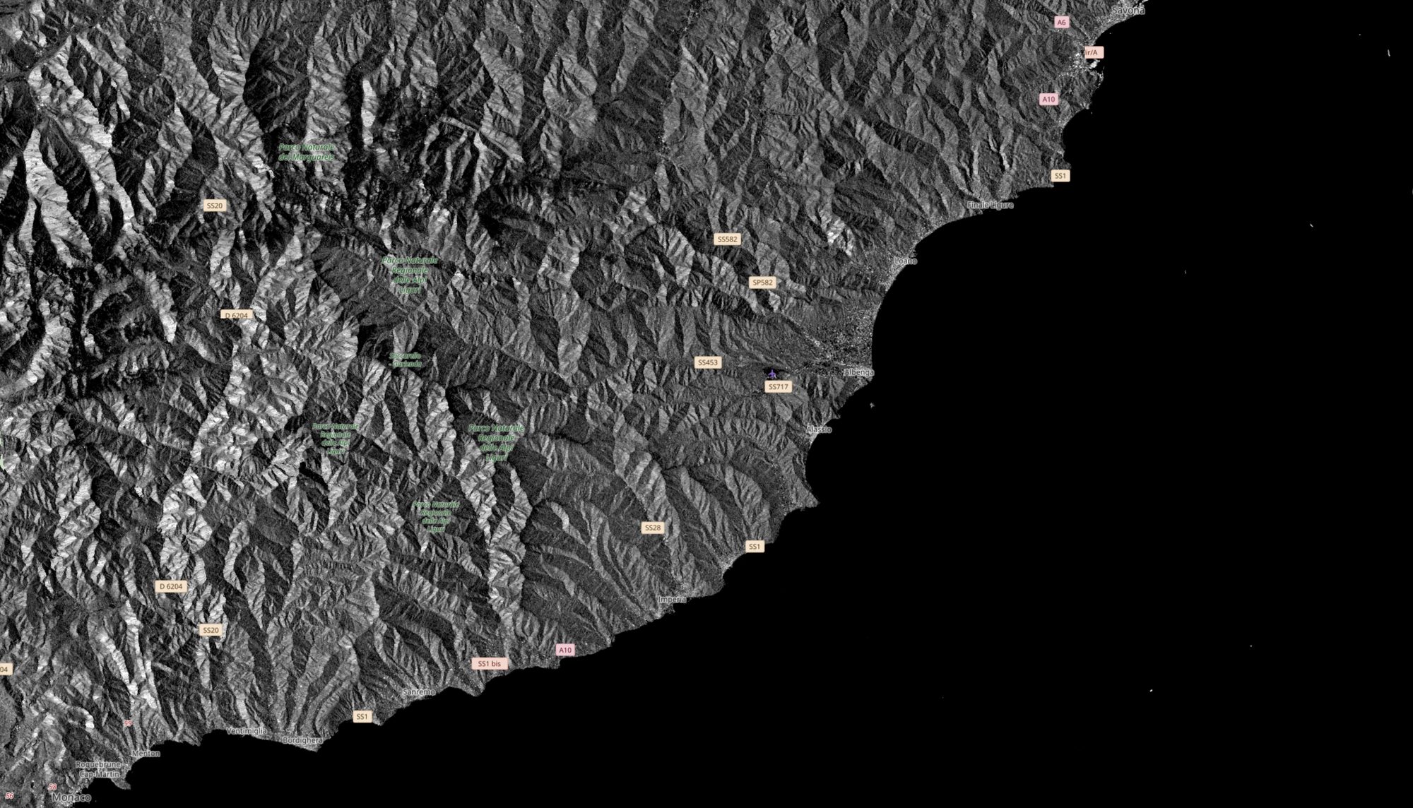
Figure 3 — The same area of western Liguria acquired by Sentinel-1: the SAR sensor returns a complete image of the surface, regardless of cloud cover. Source: Copernicus Sentinel-1 / ESA.
But there is a second reason why SAR is irreplaceable — less intuitive, but just as important: the coherence of the signal over time. By comparing two radar acquisitions of the same area taken days or weeks apart, it is possible to measure ground deformation on the order of centimeters — or even millimeters. This is the InSAR technique, radar interferometry. I have used it to analyze subsidence in the Po Valley: areas between Bologna, Ferrara and Ravenna sinking by three, four, in some cases five centimeters a year. Sentinel-1 data document this with the precision of a geodetic instrument, at regional scale, without anyone having to set foot in the field.
Sentinel-1D is already operational. Why do we need the next one?
On May 1, 2026, Sentinel-1D reached full operational status. The European constellation now has four active satellites in orbit. The contract signed in Berlin concerns the next generation — with development and launch timelines estimated over the coming decade — but the decision to launch the program now is no accident.
Radar satellites are complex instruments with a finite operational lifetime. Mission continuity — the guarantee that there are no temporal gaps in the historical data record — is itself a scientific and operational asset. An interrupted SAR time series loses part of its ability to detect slow-moving changes: subsidence, tectonic deformation, coastal evolution. The contract signed this week is, in essence, an insurance policy on the future of European radar remote sensing.
The detailed technical specifications of Sentinel-1 NG are not yet public, but ESA documents point to improvements in spatial resolution, in the flexibility of acquisition modes, and in onboard processing capability. More resolution means more detail in urban areas and critical infrastructure. More flexibility means a faster response to emergencies.
Open data: an asset Europe undervalues
There is one aspect of this story that rarely comes up in the institutional narrative: Copernicus data are free and open. Anyone — researchers, journalists, ordinary citizens, local administrations — can download Sentinel-1 imagery from the ESA archive without paying anything and without asking permission.
This model has generated an extraordinary ecosystem. Universities, research centers, startups, and civil protection agencies around the world build operational services on Copernicus data. In Italy, ISPRA monitors the coastline. Regional governments use Sentinel-2 for agricultural surveys. The Civil Protection Department integrates SAR data into flood response.
Yet this infrastructure remains largely invisible in public debate. When space comes up in conversation, it is human missions, Mars, military satellites. Rarely does anyone mention that there is a European Earth observation system, funded with public money, whose data belong to everyone, and which produces verifiable information about the planet we live on.
The contract signed in Berlin is worth hundreds of millions of euros. It is a European investment in a strategic capability — the capacity to see, measure and document what happens on the Earth’s surface, independent of who owns the commercial satellites and who decides what gets published.
What I ask of the satellite
A great many Sentinel-1 images have been processed over the past ten years. I have used this data to document the damage from the earthquake in Central Italy, to track the advance of the front lines in the conflict in Ukraine through ground deformation, to measure the melting rate of Alpine glaciers summer after summer.
Every time we look at a SAR acquisition, what we see is not an image — it is a measurement. The satellite does not interpret, does not choose the angle, does not wait for the best light. It records the return of a physical signal. This is what makes radar remote sensing a genuine tool of investigative journalism: it produces evidence that is difficult to dispute and impossible to manipulate with words.
The new Sentinel-1 satellites will do the same, with more refined instruments. That is good news.