The airstrips that changed flags
How Russia's Africa Corps is settling in, one airstrip at a time, into the outposts left behind by France and the United States
Published on Linkiesta · 3 May 2026
In little more than two years, three Sahel countries — Mali, Burkina Faso, Niger — have expelled France, forced the closure of the United Nations mission, pushed out the United States, and founded a regional military alliance, the AES, which formally left ECOWAS in January 2024. The physical space left empty — bases, airstrips, hangars, depots — did not stay empty for long. Filling it, with remarkable speed, has been Russia’s Africa Corps, the institutional heir to Wagner under the direction of the GRU since Yevgeny Prigozhin’s death in August 2023.
The advance is visible from above. High-resolution commercial satellites, notably Planet’s SkySat and Pelican fleets, periodically photograph the region’s military installations, and comparing images taken months apart makes the ongoing substitution readable, airstrip by airstrip.
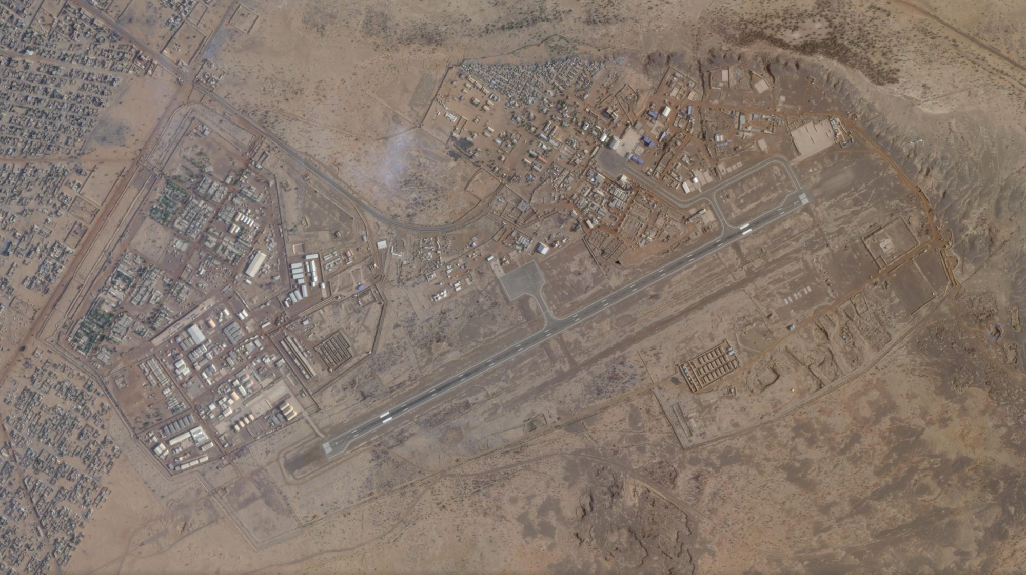
Figure 1 — Camp Castor, Gao airport (Mali). It was one of the main bases of the United Nations MINUSMA mission, run by German and Dutch contingents until the mission’s formal closure at the end of 2023. In the recent image one can make out the fortified perimeter, the western and southern logistics areas, the two-story buildings with grey roofs typical of repurposed prefabricated structures, and the runway in full service. Source: Planet Labs.
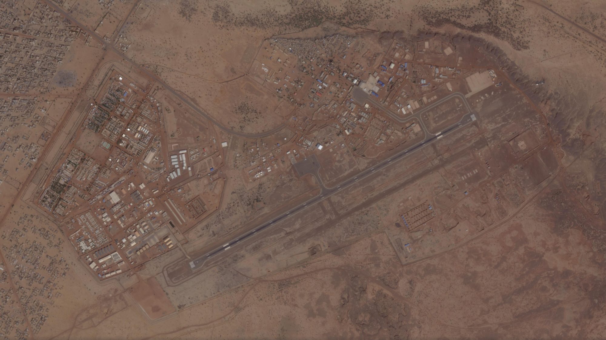
Figure 2 — The same site, some months earlier. The comparison reveals the reorganization of the area: new shelters, prefabricated units moved or added, modified storage pads. These are the signs of the handover between the departing UN contingent and the joint FAMa-Africa Corps presence that took possession of the site in early 2024. Source: Planet Labs.
Five kilometers northwest of downtown Gao, Camp Castor is the textbook case of OSINT on the Sahel: documented for years by the Dutch researchers at PAX and by the Bellingcat collective, it is today one of the main Russian operational platforms in the country, from which missions are launched into the Ménaka and Kidal regions against the Tuareg CSP-DPA groups and JNIM.
Further south, in Niamey, the capital of Niger, the junta of General Tchiani sent French troops home in the autumn of 2023 and American troops between April and July 2024. Air Base 101, next to the civilian airport, has for years been the country’s main military aviation hub.
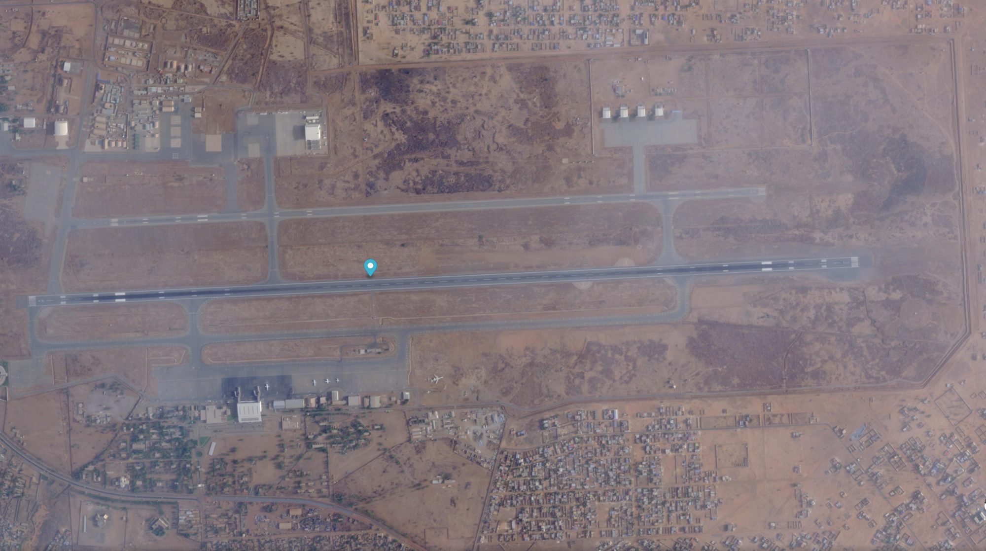
Figure 3 — Niamey, airport area. In the upper half of the image, the Diori Hamani commercial runway; in the center, the marker over the transition zone between civilian and military areas; at bottom right, the Air Base 101 complex, recognizable by the four symmetrical square aprons typical of the layout for fighter jets stationed in the region. From these aprons French Mirage 2000s operated until 2023 and American Reapers until 2024. Source: Planet Labs.
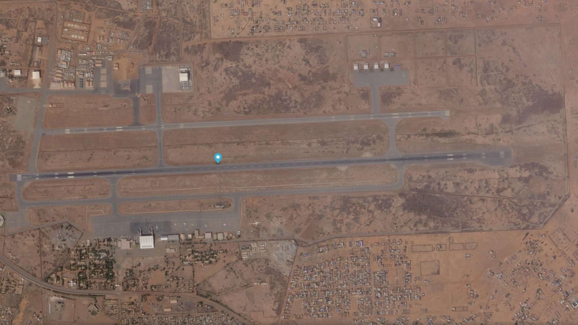
Figure 4 — The same sector some months earlier. The most notable visible difference is the reappearance of mobile shelters and new logistics clusters along the edges of the military aprons, consistent with an operational handover, and a trace of a civilian or military aircraft in transit on the runway. Source: Planet Labs.
The most striking case, however, lies five hundred kilometers to the northeast, in the Ténéré desert, where the United States had built from scratch the largest American air base constructed in Sub-Saharan Africa in the twenty-first century: Air Base 201 at Agadez, dedicated to Reaper drone surveillance across the central Sahel. Estimated cost: over 110 million dollars. Time in operation: less than eight years. Evacuated between April and July 2024.
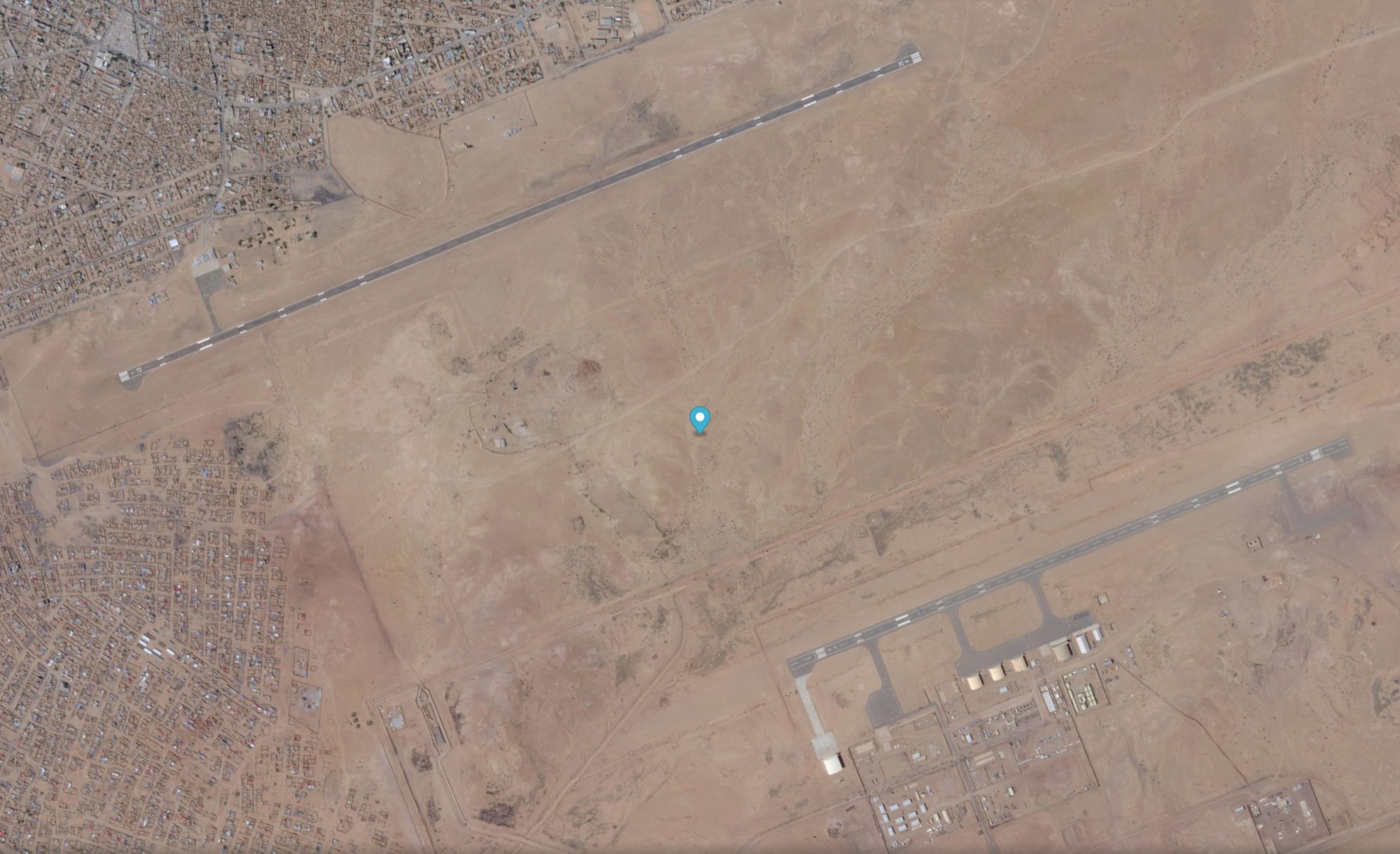
Figure 5 — Air Base 201, Agadez (Niger). The main runway, roughly 2,000 meters long, and a secondary parallel runway, built for training and as a backup. Parked aircraft are visible on the southern apron, a sign of some form of operational activity: a point on which current journalistic reporting is still divided. Source: Planet Labs.
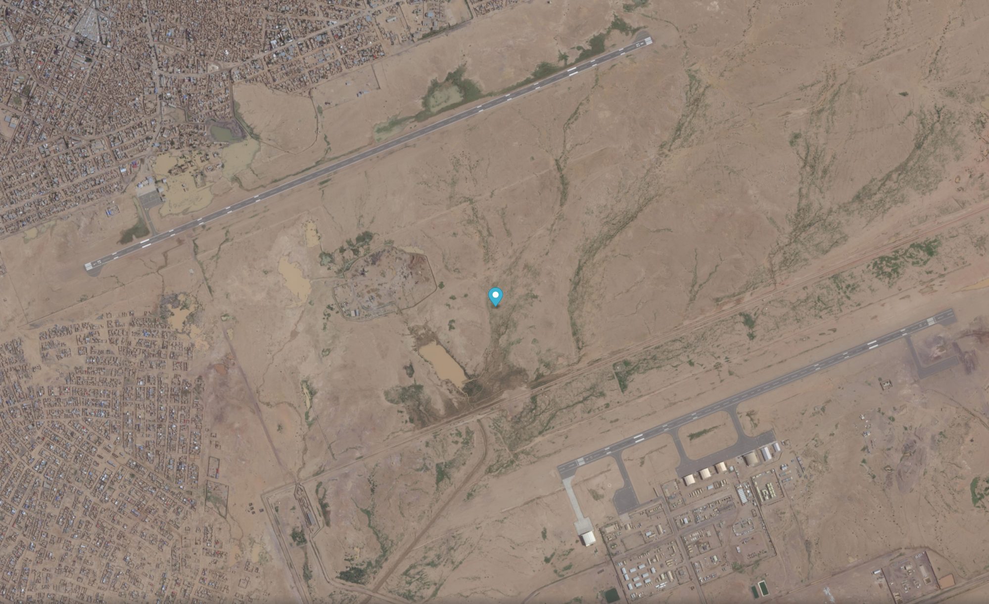
Figure 6 — The same AB201 in an earlier scene. The runways are identical — they could hardly be otherwise, concrete does not move in a year — but the southern apron appears markedly emptier. This is the difference between a base at full operational tempo and a base being wound down, or one just arriving. Source: Planet Labs.
As to what is actually flying out of Agadez today, analysts’ hypotheses range from limited tasking by the Force Aérienne du Niger to the presence of Turkish assets (Bayraktar TB2 and Akinci, already in service in Mali and Burkina Faso) and sporadic Russian presence. It is exactly the kind of question that a high-resolution SkySat or Pelican image, repeated on a weekly basis, can answer better than any official statement.
The Sahel-CAR axis is the true African headquarters of the Russian system. The Central African Republic has hosted Wagner — now Africa Corps — since 2018, in exchange for gold and diamond mining concessions and for the physical defense of Faustin-Archange Touadéra’s regime.
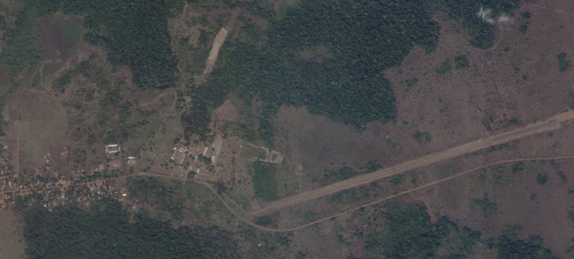
Figure 7 — Berengo, seventy kilometers south of Bangui. It was the residence of the dictator Bokassa: a palace-city built in the 1970s and later abandoned. Since 2018 it has been a training center for Wagner personnel, now Africa Corps. One can make out the original buildings and, on the right, the landing strip, lengthened and repaved in recent years. Source: Planet SkySat, acquired February 4, 2026.
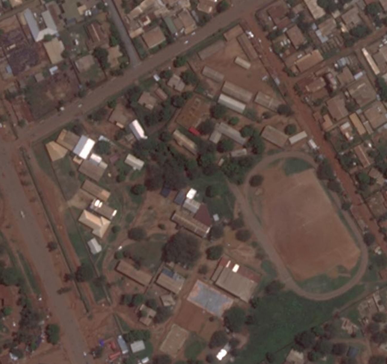
Figure 8 — Camp Béal, Bangui. Africa Corps’ headquarters in Central Africa, located in a residential neighborhood in the city center. One can make out the main command buildings, the logistics area, and the sports field to the east, repurposed as a training ground. SkySat resolution is fine enough to make out even the layout of the pitched roofs typical of newly installed prefabricated structures. Source: Planet Labs.
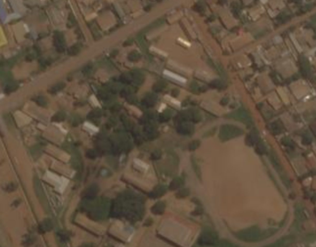
Figure 9 — The same site in an earlier acquisition, at PlanetScope resolution (3-5 meters), which, despite the lower detail, shows how the camp’s perimeter and building density have grown in recent years. Source: Planet Labs.
The cartography formed by these nine images outlines a system. Not a military occupation in the classic sense — Africa Corps is small in numbers, a few thousand men across the whole continent — but a network of essential platforms: one airport at Gao, one at Niamey, one at Agadez, two bases at Bangui and Berengo. From these points move trainers, advisers, intelligence, and at times direct operations. Behind it all, a payment system in gold and timber mining concessions that economically sustains the deployment.
For anyone watching from above, the salient fact is simple. After the closure of MINUSMA and the expulsion of France and the United States, no international observers remain on the ground. What we see of these bases comes from orbit, and almost exclusively from commercial constellations. A default choice of transparency, made a decade ago by a handful of companies and space agencies, today keeps open over the Sahel a window that, without them, would already be shut.