Wildfires in Europe, 2025 versus 2026
A comparison of EFFIS satellite burnt-area maps: the 2026 season, as of mid-August, against the record-breaking full 2025 season
Work in progress · 20 August 2026
Every colored dot on these two maps is a burnt area detected from satellite: data from EFFIS (the European Forest Fire Information System), the Copernicus Emergency Management Service’s system that has collected near-real-time fire detections across the continent since the early 2000s, combining MODIS and VIIRS imagery with burnt-area estimation algorithms. The first comparison is between the entire 2025 season — a record year for wildfires in Europe — and the 2026 season as it stands today, in mid-August, with the hottest part of summer not yet over. Drag the vertical bar to compare 2025 and 2026.
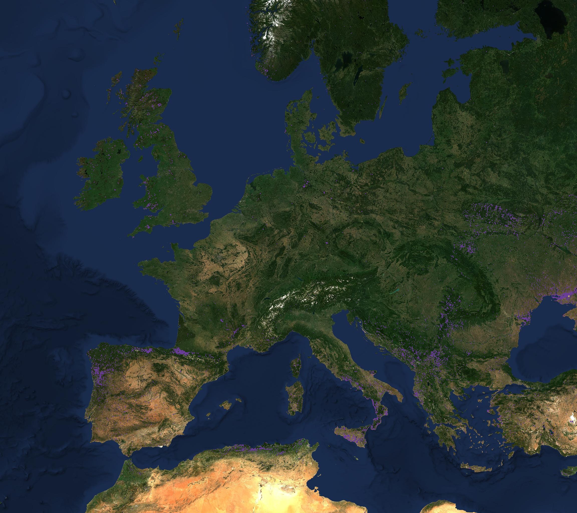
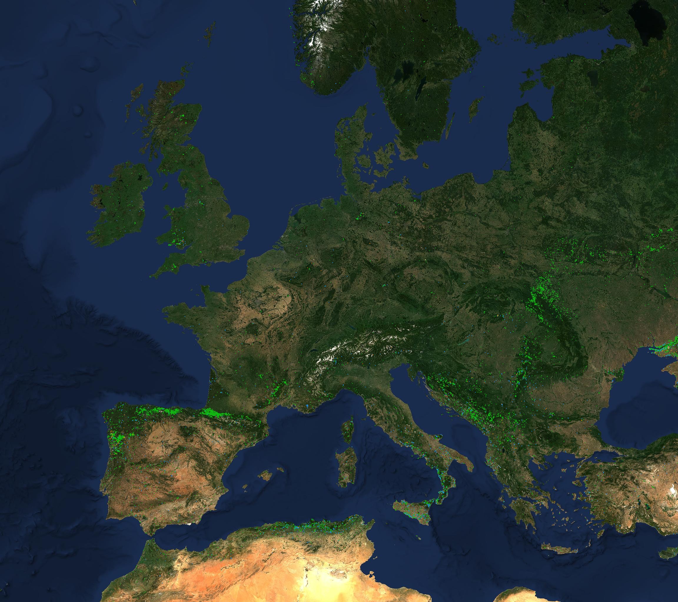
Figure 1 — Satellite-detected burnt areas in Europe: the full 2025 season compared with the 2026 season updated to August 19. Each dot is a single burnt area identified by the EFFIS algorithm from MODIS data. Source: EFFIS — Copernicus Emergency Management Service.
A 2026 season already two-thirds of the way to the 2025 record
The numbers confirm what the maps suggest at a glance: across the 27 EU countries tracked by EFFIS, 2025 was an exceptional year, with roughly 1,035,000 hectares burned over the entire season. 2026, as of mid-August, has already passed 620,000 hectares — 60% of the full 2025 total, with weeks of high-risk season still ahead. Compared with the long-term historical average — just over 350,000 hectares in a typical year — 2026 is already at 160% of that average, even as it remains more contained than the previous year. The overall picture, then, is of a season less dramatic than 2025 but still well above the norm of the last two decades.
The geography of fire shifts from year to year
The most interesting finding emerges when the total is broken down by country, because the map of risk shifts substantially from one year to the next. In 2025 the clear leader was Portugal, where fires burned over 278,000 hectares — more than 3% of the entire national territory, the highest share of any EU country. Spain followed (nearly 393,000 hectares in absolute terms, the highest raw figure but over a larger territory), and then Romania (over 129,000 hectares).
In 2026, at mid-season, the geography looks different. France and Italy have already matched or exceeded their entire 2025 totals: France went from about 37,000 to over 96,000 hectares burned, a two-and-a-half-fold increase, while Italy has already reached 86,700 hectares — more than all of 2025 (84,300), with the season still open. At the opposite end, the countries that paid the highest price in 2025 currently show clear improvement: Portugal stands at 63,000 hectares, less than a quarter of the record year’s total; Spain is at about 299,000 hectares, below its 2025 level though still the highest absolute figure in Europe; Bulgaria and Romania have both dropped to less than a seventh of their respective 2025 totals.
A note on methodology
The two maps use two distinct layers from the EFFIS WMTS service: for 2025, the consolidated “season” layer validated at year’s end; for 2026, the “current season” layer, which updates in near-real time and can therefore include preliminary detections not yet consolidated into final form. For this reason, the visual comparison between the two maps should be read as a comparison of detection patterns, while the burnt-area figures cited in the text come directly from official EFFIS statistics (the estimatesoverview endpoint), not from a count of dots on the map.
Sources: EFFIS — European Forest Fire Information System, Copernicus Emergency Management Service (data updated to August 19, 2026); map processing by Piero Boccardo, Politecnico di Torino.